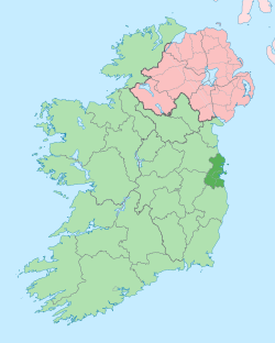
都柏林地区
外观
| 都柏林郡 (都柏林地区) Contae Bhaile Átha Cliath | |
|---|---|
| 格言:Beart do réir ár mbriathar (爱尔兰语) "Action to match our speech" | |
 | |
| 坐标:53°25′00″N 6°15′00″W / 53.416666666667°N 6.25°W | |
| 国家 | 爱尔兰 |
| 省份 | 伦斯特省 |
| 郡治 | 都柏林 |
| 政府 | |
| • Teachta Dála | 19 Labour Party TDs 17 Fine Gael TDs 4 Sinn Féin TDs 4 ULA TDs 3 Independent TDs |
| 面积 | |
| • 总计 | 921 平方公里(356 平方英里) |
| 人口(2011) | |
| • 总计 | 1,270,603人 |
| 车辆牌照 | D |
都柏林地区(英语:Dublin Region,爱尔兰语:Réigiúin Átha Cliath),原称都柏林郡(英语:County Dublin,爱尔兰语:Bhaile Átha Cliath),是爱尔兰的一个地区,位于爱尔兰岛东部海岸。包括了都柏林市、南都柏林郡、芬戈郡和邓莱里-拉斯当郡。面积921平方公里,2006年人口 1,186,821人。首府都柏林。

