
File:Thailand Bueng Kan locator map.svg

此 SVG 檔案的 PNG 預覽的大小:341 × 599 像素。 其他解析度:136 × 240 像素 | 273 × 480 像素 | 437 × 768 像素 | 582 × 1,024 像素 | 1,165 × 2,048 像素 | 1,052 × 1,849 像素。
原始檔案 (SVG 檔案,表面大小:1,052 × 1,849 像素,檔案大小:1.84 MB)
| 描述 |
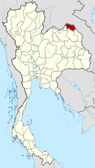
Deutsch: Lagekarte der Provinz Bueng Kan, Thailand English: Locator map of Bueng Kan Province, Thailand |
| 日期 | (UTC) |
| 來源 | |
| 作者 |
|
| 這是一張修飾過的圖片,即本圖片是用軟體修改過後的版本,修改的方式或內容有:Merged together to show Bueng Kan province。原版圖片來源:Amphoe Nong Khai.svg。修改者:Ahoerstemeier。
|
此檔案採用創用CC 姓名標示-相同方式分享 3.0 未在地化版本授權條款。
- 您可以自由:
- 分享 – 複製、發佈和傳播本作品
- 重新修改 – 創作演繹作品
- 惟需遵照下列條件:
- 姓名標示 – 您必須指名出正確的製作者,和提供授權條款的連結,以及表示是否有對內容上做出變更。您可以用任何合理的方式來行動,但不得以任何方式表明授權條款是對您許可或是由您所使用。
- 相同方式分享 – 如果您利用本素材進行再混合、轉換或創作,您必須基於如同原先的相同或兼容的條款,來分布您的貢獻成品。
原始上傳日誌
This image is a derivative work of the following images:
- File:Thailand_Nong_Khai_locator_map.svg licensed with Cc-by-3.0, GFDL
- 2009-04-21T17:01:48Z NordNordWest 1052x1849 (1525269 Bytes) {{Information |Description= {{de|Lagekarte der Provinz Nong Khai, Thailand}} {{en|Locator map of Nong Khai Province, Thailand}} |Source=self-made, using * [[:file:Thailand location map.svg|Thailand location map.svg]] |Date=2
- File:Amphoe_Nong_Khai.svg licensed with Cc-by-sa-3.0
Uploaded with derivativeFX
檔案歷史
點選日期/時間以檢視該時間的檔案版本。
| 日期/時間 | 縮圖 | 尺寸 | 使用者 | 備註 | |
|---|---|---|---|---|---|
| 目前 | 2010年8月6日 (五) 21:27 | | 1,052 × 1,849(1.84 MB) | Ahoerstemeier | {{Information |Description={{de|Lagekarte der Provinz Nong Khai, Thailand}} {{en|Locator map of Nong Khai Province, Thailand}} {{en|1=Map of Nong Khai province, Thailand, with the districts (Amphoe) numbered. #Mueang Nong Khai (อำเภอเมื� |
檔案用途
下列頁面有用到此檔案:
全域檔案使用狀況
以下其他 wiki 使用了這個檔案:
- ar.wikipedia.org 的使用狀況
- be.wikipedia.org 的使用狀況
- cdo.wikipedia.org 的使用狀況
- ckb.wikipedia.org 的使用狀況
- de.wikipedia.org 的使用狀況
- de.wikivoyage.org 的使用狀況
- en.wikipedia.org 的使用狀況
- Bueng Khong Long district
- Bung Khla district
- Pak Khat district
- Si Wilai district
- Seka district
- So Phisai district
- Bueng Kan province
- Seals of the provinces of Thailand
- Template:BuengKan-geo-stub
- Si Wilai subdistrict
- Chumphu Phon
- Phon Charoen
- Tha Kok Daeng
- Seka subdistrict
- Bueng Khong Long subdistrict
- Dong Bang, Bueng Kan
- Pho Mak Khaeng
- Tha Dok Kham
- Bung Khla subdistrict
- Khok Kwang
- Nong Doen
- Pak Khat subdistrict
- Nong Yong
- Na Kang
- Na Dong
- Non Sila, Bueng Kan
- Som Sanuk
- Don Ya Nang
- Nong Hua Chang
- Pa Faek, Bueng Kan
- Si Chomphu, Phon Charoen
- Si Samran
- Wang Chomphu
- Ban Tong
- Nam Chan
- Nong Thum
- Pong Hai
- Sang, Bueng Kan
- Sok Kam
- Tha Sa-at
- Na Sabaeng
- Na Saeng, Bueng Kan
- Na Sing
檢視此檔案的更多全域使用狀況。