
File:Kalgin Island from space.jpg

預覽大小:800 × 547 像素。 其他解析度:320 × 219 像素 | 640 × 438 像素 | 1,024 × 700 像素 | 1,275 × 872 像素。
原始檔案 (1,275 × 872 像素,檔案大小:756 KB,MIME 類型:image/jpeg)
摘要
| 描述 |
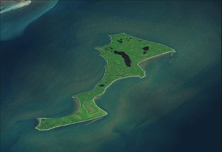
Română: Kalgin Island from space. |
| 來源 | Topographic data SRTM from NASA and World Imagery - NASA World Wind & 3Dem & Inkscape |
| 作者 | Asybaris01 |
授權條款
| 本圖像屬於公有領域,因其為NASA的World Wind衛星地圖瀏覽器的一張截圖,且使用了公有領域圖層,如Blue Marble、MODIS、Landsat、SRTM、USGS、GLOBE等。
|
 |

|
本圖像的分類需要調整。 按此檢查
|
檔案歷史
點選日期/時間以檢視該時間的檔案版本。
| 日期/時間 | 縮圖 | 尺寸 | 使用者 | 備註 | |
|---|---|---|---|---|---|
| 目前 | 2011年10月7日 (五) 18:53 | | 1,275 × 872(756 KB) | Asybaris01 | {{Information |Description ={{ro|1=Kalgin Island from space.}} |Source =Topographic data SRTM from NASA and World Imagery - NASA World Wind & 3Dem & Inkscape |Author =Asybaris01 |Date = |Permission = |o |
檔案用途
下列頁面有用到此檔案:
全域檔案使用狀況
以下其他 wiki 使用了這個檔案:
- en.wikipedia.org 的使用狀況
- it.wikipedia.org 的使用狀況
- ja.wikipedia.org 的使用狀況