
File:Hungary map 1941.png

預覽大小:800 × 578 像素。 其他解析度:320 × 231 像素 | 640 × 462 像素 | 1,022 × 738 像素。
原始檔案 (1,022 × 738 像素,檔案大小:69 KB,MIME 類型:image/png)
摘要
| 描述 |
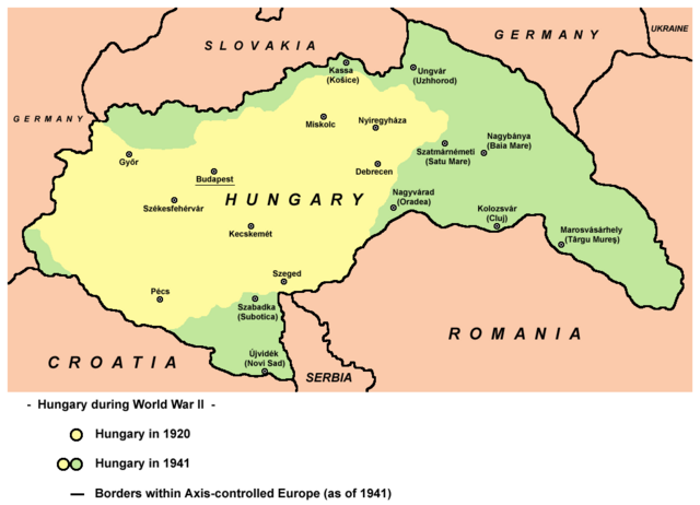
English: Hungary in 1920 and in 1941. |
| 日期 | |
| 來源 | 自己的作品 |
| 作者 | User:PANONIAN |
| 其他版本 |
Derivative works of this file: |
References
- The Times History of Europe, Times Books, London, 2002.
- Richard Overy, The Times History of the 20th Century, Times Books, London, 2004.
- Peter Rokai - Zoltan Đere - Tibor Pal - Aleksandar Kasaš, Istorija Mađara, Beograd, 2002.
- http://terkepek.adatbank.transindex.ro/kepek/netre/224.gif
- http://www.hunmagyar.org/tor/terkep.jpg
- http://www.map.hu/galeria/orig/1426_hu_in_maps_fig_12_states_1648-2009.jpg archive copy at the Wayback Machine
授權條款
| 此作品已由其作者,PANONIAN,釋出至公有領域。此授權條款在全世界均適用。 這可能在某些國家不合法,如果是的話: |

|
This map has been uploaded by Electionworld from en.wikipedia.org to enable the |
檔案歷史
點選日期/時間以檢視該時間的檔案版本。
| 日期/時間 | 縮圖 | 尺寸 | 使用者 | 備註 | |
|---|---|---|---|---|---|
| 目前 | 2014年2月11日 (二) 19:22 | | 1,022 × 738(69 KB) | PANONIAN | aesthetics, corrections |
| 2010年7月11日 (日) 10:43 |  | 1,023 × 738(69 KB) | PANONIAN | Reverted to version as of 19:28, 16 December 2009 - please upload your map as separate file, not over this one | |
| 2010年7月9日 (五) 16:43 |  | 1,023 × 738(60 KB) | Mix321 | drobne | |
| 2009年12月16日 (三) 19:28 |  | 1,023 × 738(69 KB) | PANONIAN | Reverted to version as of 19:23, 16 December 2009 - fixing thumbnail problem | |
| 2009年12月16日 (三) 19:26 |  | 800 × 540(16 KB) | PANONIAN | Reverted to version as of 23:57, 23 December 2006 - fixing thumbnail problem | |
| 2009年12月16日 (三) 19:23 |  | 1,023 × 738(69 KB) | PANONIAN | improved version | |
| 2006年12月23日 (六) 23:57 |  | 800 × 540(16 KB) | Electionworld | {{ew|en|PANONIAN}} == Licensing == {{PD-user|PANONIAN}} Category:Maps of the history of Hungary Category:Maps of the history of Romania |
檔案用途
下列4個頁面有用到此檔案:
全域檔案使用狀況
以下其他 wiki 使用了這個檔案:
- ar.wikipedia.org 的使用狀況
- ast.wikipedia.org 的使用狀況
- ba.wikipedia.org 的使用狀況
- be.wikipedia.org 的使用狀況
- bg.wikipedia.org 的使用狀況
- bs.wikipedia.org 的使用狀況
- ca.wikipedia.org 的使用狀況
- cs.wikipedia.org 的使用狀況
- cv.wikipedia.org 的使用狀況
- en.wikipedia.org 的使用狀況
- eo.wikipedia.org 的使用狀況
- fo.wikipedia.org 的使用狀況
- fr.wikipedia.org 的使用狀況
- gl.wikipedia.org 的使用狀況
- he.wikipedia.org 的使用狀況
- hr.wikipedia.org 的使用狀況
- hu.wikipedia.org 的使用狀況
- is.wikipedia.org 的使用狀況
- it.wikipedia.org 的使用狀況
- ja.wikipedia.org 的使用狀況
- jv.wikipedia.org 的使用狀況
- ko.wikipedia.org 的使用狀況
- lt.wikipedia.org 的使用狀況
- nl.wikipedia.org 的使用狀況
- pl.wikipedia.org 的使用狀況
- pt.wikipedia.org 的使用狀況
- ro.wikipedia.org 的使用狀況
檢視此檔案的更多全域使用狀況。