
File:Ghaznavid Empire 975 - 1187 (AD).PNG
此為最大尺寸。
Ghaznavid_Empire_975_-_1187_(AD).PNG (620 × 428 像素,檔案大小:20 KB,MIME 類型:image/png)
.PNG?uselang=zh-tw)
.PNG?uselang=zh-tw)
.PNG?action=history&uselang=zh-tw)
.PNG)
摘要
| 描述 |
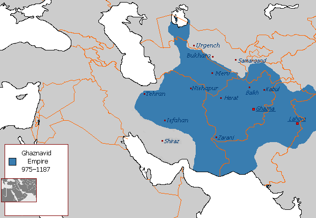
Polski: Państwo Ghaznawidów
English: Ghaznavid Empire |
| 日期 | |
| 來源 | 自己的作品 |
| 作者 | Arab League |
| 其他版本 | Arabic |
-ar.PNG)
授權條款
| 此作品已由其作者,英文維基百科的Arab League,釋出至公有領域。此授權條款在全世界均適用。 這可能在某些國家不合法,如果是的話: Arab League授予任何人有權利使用此作品於任何用途,除受法律約束外,不受任何限制。 |
檔案歷史
點選日期/時間以檢視該時間的檔案版本。
.PNG&variant=zh-tw&dir=prev)
.PNG&variant=zh-tw&offset=20130607145450)
.PNG&variant=zh-tw&offset=&limit=20)
.PNG&variant=zh-tw&offset=&limit=50)
.PNG&variant=zh-tw&offset=&limit=100)
.PNG&variant=zh-tw&offset=&limit=250)
.PNG&variant=zh-tw&offset=&limit=500)
| 日期/時間 | 縮圖 | 尺寸 | 使用者 | 備註 | |
|---|---|---|---|---|---|
| 目前 | 2015年7月7日 (二) 04:54 | | 620 × 428(20 KB) | HistoryofIran | Of course Iranica doesn't, it states which areas they ruled at their extent, stop making reverts without discussing.. |
| 2015年7月4日 (六) 01:05 |  | 619 × 428(21 KB) | Persia10101 | More accurate map after some research | |
| 2015年7月4日 (六) 01:05 |  | 619 × 428(21 KB) | Persia10101 | More accurate map after some research | |
| 2015年7月4日 (六) 00:58 |  | 620 × 428(26 KB) | Persia10101 | Iranica doesnt show a map. reverting to the more commonly agreed map | |
| 2015年7月4日 (六) 00:57 |  | 620 × 428(26 KB) | Persia10101 | Reverted to version as of 08:05, 14 August 2011 | |
| 2014年5月9日 (五) 12:08 |  | 620 × 428(20 KB) | HistoryofIran | Further fixed the map, i will be adding vassals later. | |
| 2014年1月28日 (二) 23:47 |  | 620 × 428(20 KB) | HistoryofIran | Fars and Kerman remained under Buyid rule until the Seljuqs came. | |
| 2013年6月7日 (五) 15:01 |  | 620 × 428(20 KB) | HistoryofIran | Fixed the map, according to Iranica the map was like this at it's greatest extent. | |
| 2013年6月7日 (五) 14:58 |  | 620 × 428(20 KB) | HistoryofIran | Fixed the map, according to Iranica the map was like this at it's greatest extent. | |
| 2013年6月7日 (五) 14:54 |  | 620 × 428(20 KB) | HistoryofIran | Fixed the map, according to Iranica the map was like this at it's greatest extent. |
檔案用途
全域檔案使用狀況
以下其他 wiki 使用了這個檔案:
- arz.wikipedia.org 的使用狀況
- ast.wikipedia.org 的使用狀況
- av.wikipedia.org 的使用狀況
- azb.wikipedia.org 的使用狀況
- az.wikipedia.org 的使用狀況
- ba.wikipedia.org 的使用狀況
- be.wikipedia.org 的使用狀況
- bg.wikipedia.org 的使用狀況
- bn.wikipedia.org 的使用狀況
- ca.wikipedia.org 的使用狀況
- ceb.wikipedia.org 的使用狀況
- ckb.wikipedia.org 的使用狀況
- da.wikipedia.org 的使用狀況
- de.wikipedia.org 的使用狀況
- el.wikipedia.org 的使用狀況
- en.wikipedia.org 的使用狀況
- Muslim conquests of Afghanistan
- History of Afghanistan
- Turkic peoples
- Greater Iran
- Jasrota
- User:Arab Hafez/Map
- Portal:Afghanistan
- Shia Islam in the Indian subcontinent
- User:Ottava Rima/Persian Empire
- User:Sobreira/Religion
- Muslim conquest of Khorasan
- Nurpur kingdom
- User:Northamerica1000/Portals of the world
- User:Kansas Bear/Ghaznavids
- User:Kypioys sx/sandbox
- User:Kansas Bear/Saffarid dynasty
- eo.wikipedia.org 的使用狀況
- es.wikipedia.org 的使用狀況
檢視此檔案的更多全域使用狀況。
.PNG)
.PNG)