
File:European Union Exclusive Economic Zones.PNG
預覽大小:767 × 600 像素。 其他解析度:307 × 240 像素 | 614 × 480 像素 | 982 × 768 像素 | 1,280 × 1,001 像素 | 2,560 × 2,002 像素 | 4,572 × 3,576 像素。
原始檔案 (4,572 × 3,576 像素,檔案大小:1.65 MB,MIME 類型:image/png)
摘要
| 描述 |
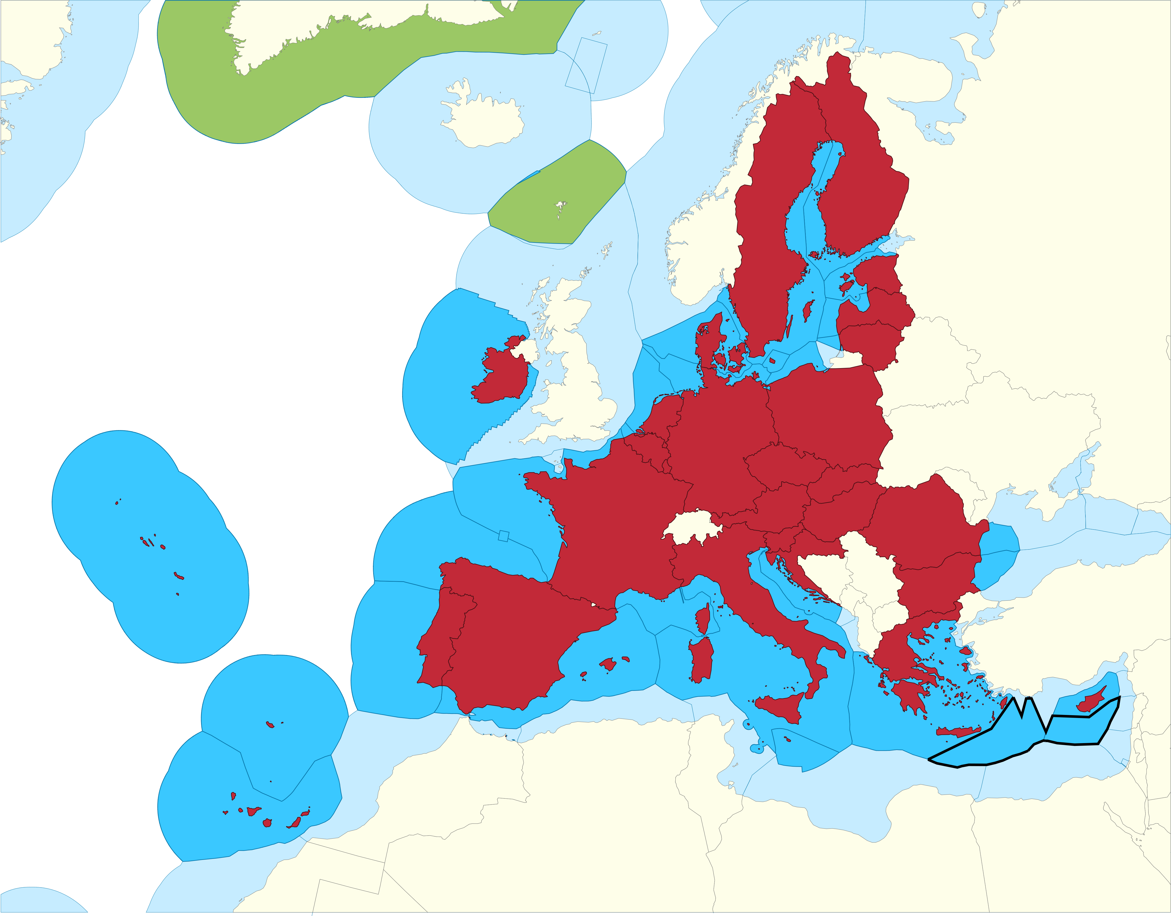
English: European Union Member states Exclusive Economic Zones |
|||
| 日期 | ||||
| 來源 |
EU member states Exclusive Economic Zones
EU member states overseas territories Exclusive Economic Zones
EU member states
Disputed Exclusive Economic Zones |
|||
| 作者 | Sette-quattro, replacing the previous work done by Luis_wiki | |||
| 授權許可 (重用此檔案) |
Own work | |||
| 其他版本 |
|


授權條款
| 我,此作品的版權所有人,釋出此作品至公共領域。此授權條款在全世界均適用。 這可能在某些國家不合法,如果是的話: 我授予任何人有權利使用此作品於任何用途,除受法律約束外,不受任何限制。 |
檔案歷史
點選日期/時間以檢視該時間的檔案版本。
| 日期/時間 | 縮圖 | 尺寸 | 使用者 | 備註 | |
|---|---|---|---|---|---|
| 目前 | 2021年2月17日 (三) 11:14 | | 4,572 × 3,576(1.65 MB) | Ahmetlii | higher resolution |
| 2021年2月17日 (三) 11:09 |  | 1,280 × 997(308 KB) | Ahmetlii | added the disputed EEZ border per en:Cyprus–Turkey maritime zones dispute | |
| 2020年9月8日 (二) 21:33 |  | 4,572 × 3,566(1.22 MB) | Sette-quattro | updated without UK, clearer boundaries | |
| 2011年7月16日 (六) 08:54 |  | 485 × 294(86 KB) | Epipelagic | Somewhat simplified the map | |
| 2010年12月23日 (四) 11:12 |  | 489 × 298(19 KB) | Begg maps | {{Information |Description={{es|1=-}} |Source=- |Author=- |Date=- |Permission= |other_versions= }} | |
| 2007年8月27日 (一) 23:31 |  | 489 × 298(19 KB) | Luis wiki | {{Information |Description= European Union Member states Exclusive Economic Zones |Source= Own work over screen capture of Map Interface of VLIZ Maritime Boundaries Geodatabase (http://w2.vliz.be/vmdcdata/marbound/geointerface.php) |Date= 28 August 2007 |
檔案用途
下列頁面有用到此檔案:
全域檔案使用狀況
以下其他 wiki 使用了這個檔案:
- ar.wikipedia.org 的使用狀況
- ast.wikipedia.org 的使用狀況
- ca.wikipedia.org 的使用狀況
- cs.wikipedia.org 的使用狀況
- en.wikipedia.org 的使用狀況
- es.wikipedia.org 的使用狀況
- eu.wikipedia.org 的使用狀況
- fi.wikipedia.org 的使用狀況
- he.wikipedia.org 的使用狀況
- id.wikipedia.org 的使用狀況
- it.wikipedia.org 的使用狀況
- ja.wikipedia.org 的使用狀況
- ko.wikipedia.org 的使用狀況
- no.wikipedia.org 的使用狀況
- pt.wikipedia.org 的使用狀況
- sv.wikipedia.org 的使用狀況
- uk.wikipedia.org 的使用狀況