
File:Europe 1748-1766.png
預覽大小:800 × 570 像素。 其他解析度:320 × 228 像素 | 640 × 456 像素 | 1,024 × 730 像素 | 1,280 × 913 像素 | 2,560 × 1,825 像素 | 3,872 × 2,761 像素。
原始檔案 (3,872 × 2,761 像素,檔案大小:1.47 MB,MIME 類型:image/png)
摘要
| 描述 |
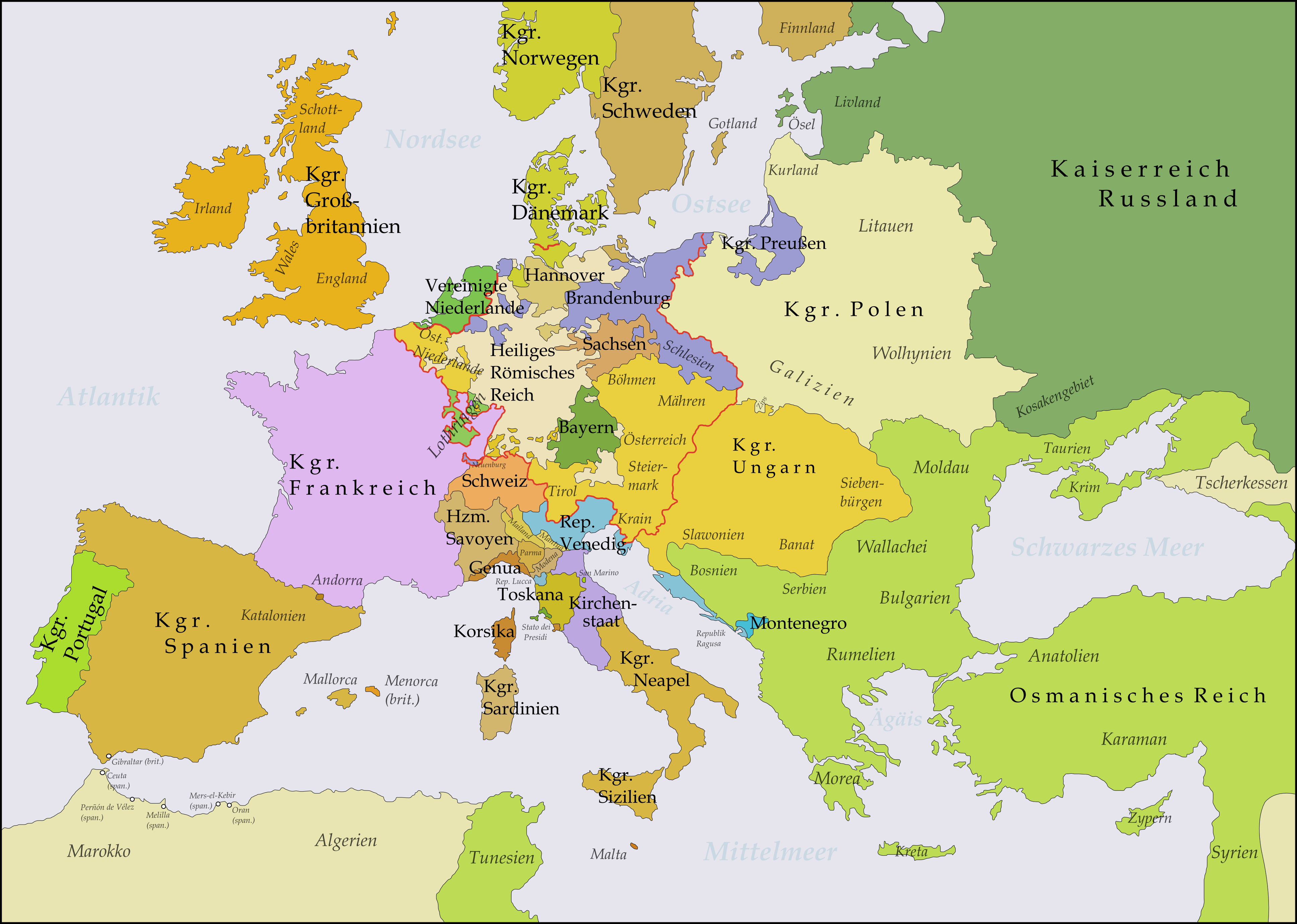
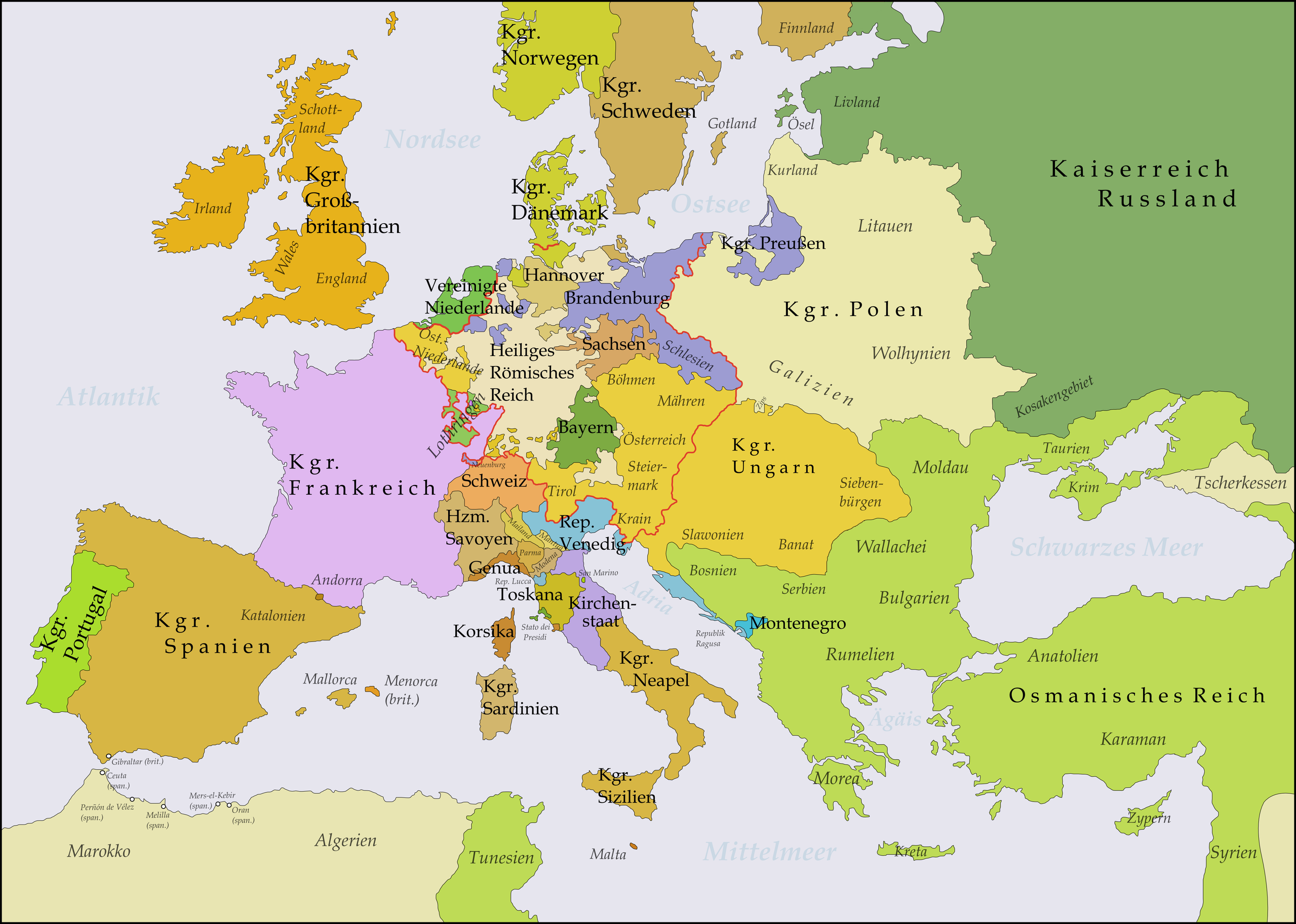
Deutsch: Diese Karte zeigt Europa in den Jahren nach dem Frieden von Aachen 1748 und in der Zeit des Siebenjährigen Krieges (1756-1763). Bis 1766 kam es zu keinen größeren geographischen Veränderungen in Europa.
Die Arbeit wurde mit Inkscape erstellt und beruht hauptsächlich auf einer Karte in: Putzger - Historischer Weltatlas, Berlin 1990, S.78f.
English: This map shows Europe in the years after the Treaty of Aix-la-Chapelle 1748 and the Seven Years' War (1756-1763). Europe did not see another major geographical change until 1766. The red line marks the borders of the Holy Roman Empire.
The work was created with Inkscape and is mainly based on a map in: Putzger - Historischer Weltatlas, Berlin 1990, 78 pp.
Français : Cette carte montre l'Europe dans les années après le Traité d'Aix-la-Chapelle (1748) et pendant les années de la Guerre des Sept Ans (1756-1763). L'Europe n'a pas vu un autre changement géographique important jusqu'à 1766.
Le travail a été créé avec Inkscape et il est basé principalement sur une carte dans: Putzger - Historischer Weltatlas, Berlin 1990, 78 pp.
Polski: Ta mapa ukazuje Europę w latach po pokoju w Akwizgranie z 1748 i wojnie siedmioletniej (1756-1763). Europa nie uświadczyła żadnych poważniejszych zmian geograficznych aż do 1766. Czerwona linia znaczy granice Świętego Cesarstwa Rzymskiego.
Praca została stworzona z użyciem Inkscape i powstała głównie na bazie mapy w: Putzger - Historischer Weltatlas, Berlin 1990, 78 pp.
Русский: Эта карта представляет Европу после заключения Аахенского мира в 1748 г. и во время Семилетней войны (1756-1763 гг.). До 1766 г. эта картина Европы не изменилась.
Эта работа нарисована с помощью программы Inkscape и основана на карте из книги: Putzger - Historischer Weltatlas, Berlin 1990, 78 cc. |
||
| 日期 | |||
| 來源 | 自己的作品 | ||
| 作者 | Memnon335bc | ||
| 其他版本 |
|

_en.png)
.png)
.jpg)
授權條款
我,本作品的著作權持有者,決定用以下授權條款發佈本作品:
此檔案採用創用CC 姓名標示 3.0 未在地化版本授權條款。
- 您可以自由:
- 分享 – 複製、發佈和傳播本作品
- 重新修改 – 創作演繹作品
- 惟需遵照下列條件:
- 姓名標示 – 您必須指名出正確的製作者,和提供授權條款的連結,以及表示是否有對內容上做出變更。您可以用任何合理的方式來行動,但不得以任何方式表明授權條款是對您許可或是由您所使用。
檔案歷史
點選日期/時間以檢視該時間的檔案版本。
| 日期/時間 | 縮圖 | 尺寸 | 使用者 | 備註 | |
|---|---|---|---|---|---|
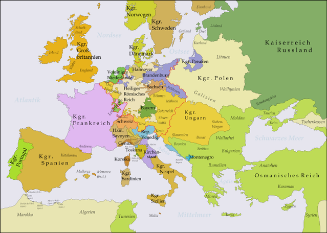
| 目前 | 2017年10月21日 (六) 02:51 | | 3,872 × 2,761(1.47 MB) | Bryanrutherford0 | Transferred control of Saaremaa and Hiiumaa to Russia (1721 Treaty of Nystad) and adjusted Russian-Swedish border in Finland to reflect Russian gains in the 1743 Treaty of Åbo after the Russo-Swedish War. |
| 2009年11月5日 (四) 20:51 |  | 3,872 × 2,761(1.47 MB) | Alex:D | Border correction (Oltenia was part of Wallachia since 1738) | |
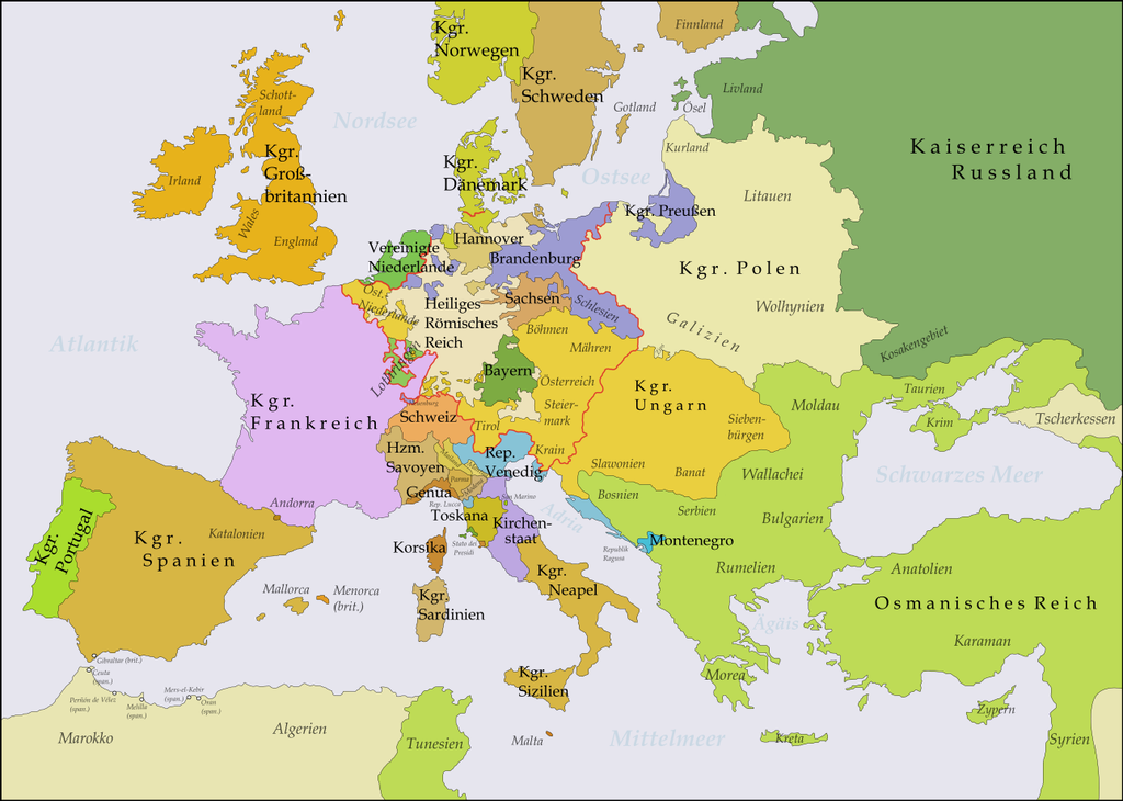
| 2009年8月31日 (一) 21:03 |  | 3,872 × 2,761(1.64 MB) | Memnon335bc | Zips, PrussianBorders, Ostfriesland, Neuenburg, Reich-Borders corrected | |
| 2009年8月30日 (日) 22:39 |  | 3,872 × 2,761(1.64 MB) | Memnon335bc | {{Information |Description={{en|1=This map shows Europe in the years after the Treaty of Aix-la-Chapelle 1748 and the Seven Years' War (1756-1763). Europe didn't see another major geographi |
檔案用途
全域檔案使用狀況
以下其他 wiki 使用了這個檔案:
- de.wikipedia.org 的使用狀況
- 1748
- 1756
- Siebenjähriger Krieg
- Katharina II.
- Friede von Aachen (1748)
- Renversement des alliances
- Deutscher Dualismus
- Sächsische Armee
- Ostfriesland zur Zeit des Siebenjährigen Krieges
- Benutzer:KaterBegemot/Kartografen
- Benutzer Diskussion:Niabot/Archiv/2011
- Benutzer:Memnon335bc
- Deutsch-russische Beziehungen
- Benutzer:Mr N/Landkarten und Übersichten für Bücher
- Wikipedia:Bücher/Die Epoche der Aufklärung (2)/Quellen & Bildanhang
- Benutzer:Eandré/Karten
- Nordisches System
- Preußisch-russischer Allianzvertrag (1762)
- Preußisch-russischer Allianzvertrag (1764)
- Brandenburgisch-sächsische Beziehungen
- de.wikibooks.org 的使用狀況
- es.wikipedia.org 的使用狀況
- fr.wikipedia.org 的使用狀況
- hr.wikipedia.org 的使用狀況
- lb.wikipedia.org 的使用狀況
- nl.wikipedia.org 的使用狀況
- pfl.wikipedia.org 的使用狀況
- pl.wikipedia.org 的使用狀況
- ro.wikipedia.org 的使用狀況
- ru.wikipedia.org 的使用狀況
- sh.wikipedia.org 的使用狀況
- sl.wikipedia.org 的使用狀況
- uk.wikipedia.org 的使用狀況
- vi.wikipedia.org 的使用狀況