
File:Satellite View of Japan 1999.jpg
預覽大小:469 × 599 像素。 其他解析度:188 × 240 像素 | 376 × 480 像素 | 601 × 768 像素 | 802 × 1,024 像素 | 1,638 × 2,092 像素。
原始檔案 (1,638 × 2,092 像素,檔案大小:1.04 MB,MIME 類型:image/jpeg)
摘要
| 描述 |
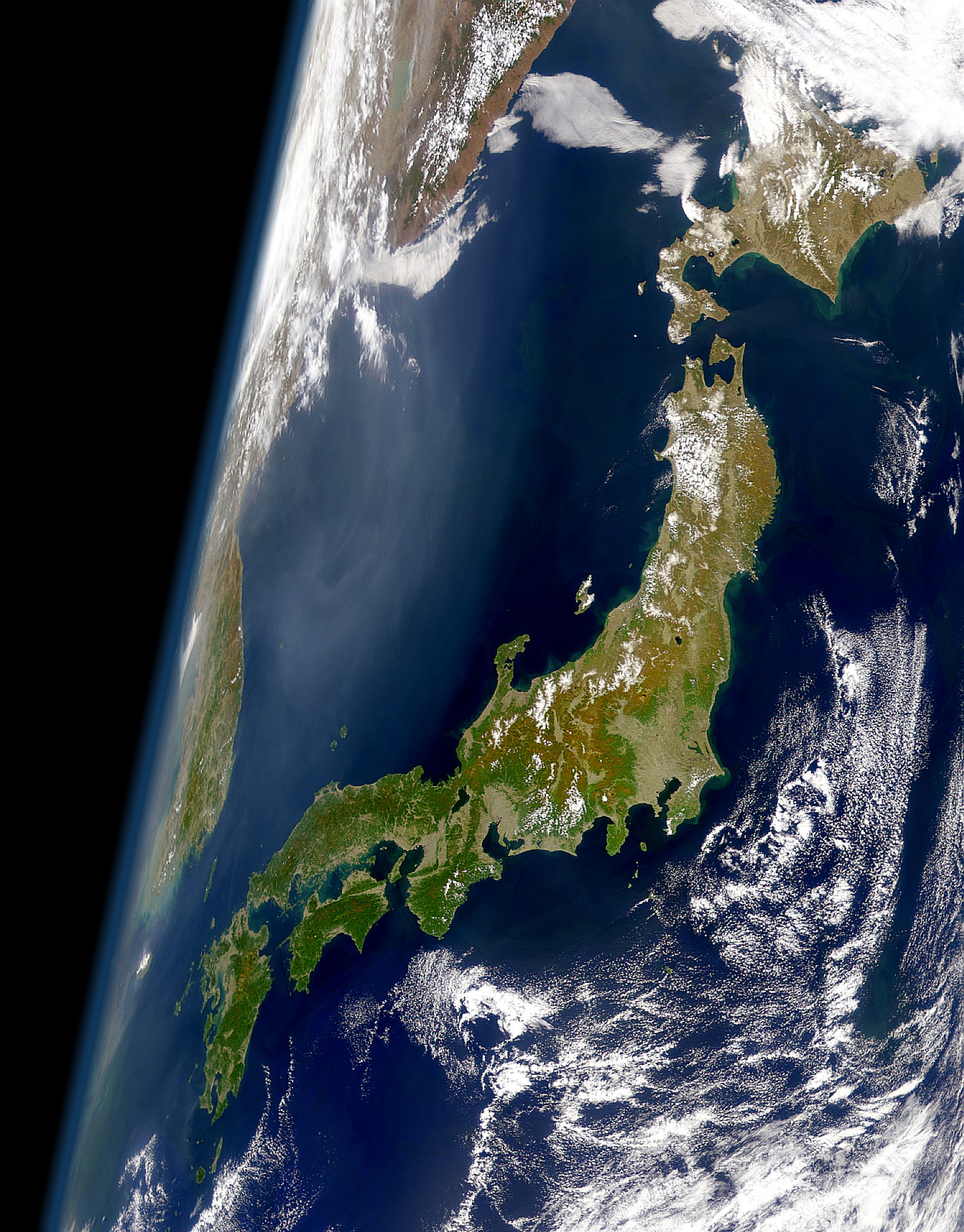
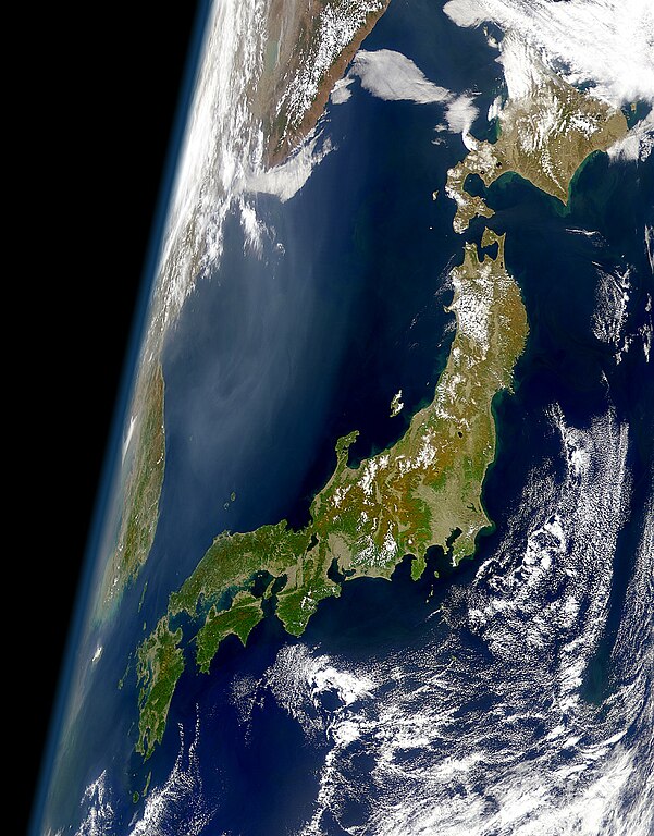
English: View of Japan taken from a satellite (1999)
日本語: 衛星から見た日本(1999年) |
| 日期 | |
| 來源 | Cropped version of the high resolution variation of image found at: https://visibleearth.nasa.gov/images/52957/clear-view-of-japan |
| 作者 | SeaWiFS Project, NASA/Goddard Space Flight Center, and ORBIMAGE |
授權條款
| This image is from the Sea-viewing Wide Field-of-view Sensor (SeaWiFS) Project and more than 5 years old.
Satellite data captured by the SeaWIFS sensor are released into the public domain 5 years after capture. Data less than five years old can be re-used only for educational or scientific purposes; any commercial use of such images must be coordinated with GeoEye. [1] |
| This work has been released into the public domain by its copyright holder, GeoEye. This applies worldwide. 這可能在某些國家不合法,如果是的話: GeoEye授予任何人有權利使用此作品於任何用途,除受法律約束外,不受任何限制。
|
檔案歷史
點選日期/時間以檢視該時間的檔案版本。
| 日期/時間 | 縮圖 | 尺寸 | 用戶 | 備註 | |
|---|---|---|---|---|---|
| 目前 | 2008年1月26日 (六) 01:11 | | 1,638 × 2,092(1.04 MB) | Satelite of Love | {{Information |Description=View of Japan take from a satellite (1999) |Source=Cropped version of the high resolution variation of image found at: http://visibleearth.nasa.gov/cgi-bin/viewrecord?10466 |Date=Jan. 24, 2008 |Author= [[User:Satelite of Love|Sa |
檔案用途
全域檔案使用狀況
以下其他 wiki 使用了這個檔案:
- af.wikipedia.org 的使用狀況
- am.wikipedia.org 的使用狀況
- ar.wikipedia.org 的使用狀況
- ast.wikipedia.org 的使用狀況
- azb.wikipedia.org 的使用狀況
- bat-smg.wikipedia.org 的使用狀況
- be-tarask.wikipedia.org 的使用狀況
- be.wikipedia.org 的使用狀況
- bg.wikipedia.org 的使用狀況
- bm.wikipedia.org 的使用狀況
- bn.wikipedia.org 的使用狀況
- bo.wikipedia.org 的使用狀況
- br.wiktionary.org 的使用狀況
- bs.wikipedia.org 的使用狀況
- ca.wikipedia.org 的使用狀況
- ca.wikinews.org 的使用狀況
- cs.wikipedia.org 的使用狀況
- da.wikipedia.org 的使用狀況
- de.wikipedia.org 的使用狀況
- el.wikipedia.org 的使用狀況
- en.wikipedia.org 的使用狀況
- en.wikibooks.org 的使用狀況
- en.wikiquote.org 的使用狀況
- eo.wikipedia.org 的使用狀況
- es.wikipedia.org 的使用狀況
- et.wikipedia.org 的使用狀況
- fa.wikipedia.org 的使用狀況
- fi.wikipedia.org 的使用狀況
- fr.wikipedia.org 的使用狀況
- gl.wikipedia.org 的使用狀況
- hi.wikipedia.org 的使用狀況
- hr.wikipedia.org 的使用狀況
- hy.wikipedia.org 的使用狀況
- id.wikipedia.org 的使用狀況
檢視此檔案的更多全域使用狀況。