
File:PIA13164 North Polar Cap Cross Section.jpg

預覽大小:800 × 388 像素。 其他解析度:320 × 155 像素 | 640 × 310 像素 | 1,024 × 497 像素 | 1,936 × 939 像素。
原始檔案 (1,936 × 939 像素,檔案大小:562 KB,MIME 類型:image/jpeg)
摘要
| 描述 |
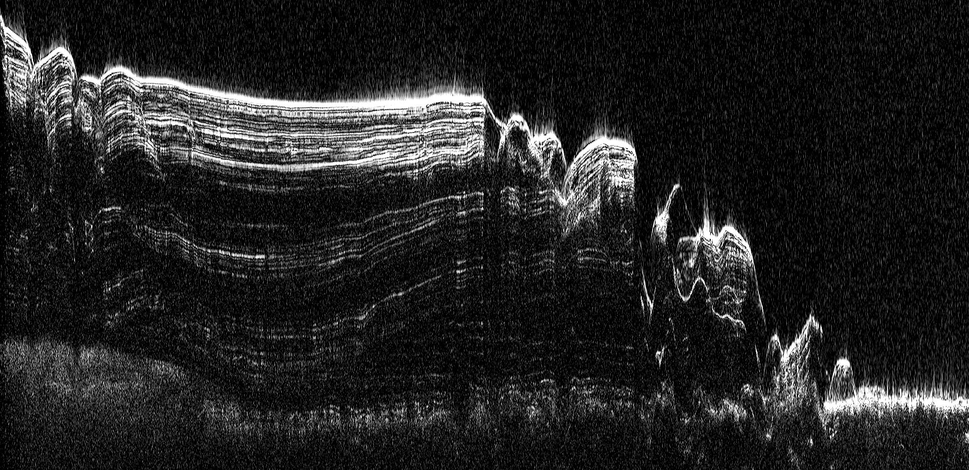
English: This image shows a cross-section of a portion of the north polar ice cap of Mars, derived from data acquired by the Mars Reconnaissance Orbiter's Shallow Radar (SHARAD), one of six instruments on the spacecraft.
The data depict the region's internal ice structure, with annotations describing different layers. The ice depicted in this graphic is approximately 2 kilometers (1.2 miles) thick and 250 kilometers (155 miles) across. White lines show reflection of the radar signal back to the spacecraft. Each line represents a place where a layer sits on top of another. Scientists study how thick the pancake-like layers are, where they bulge and how they tilt up or down to understand what the surface of the ice sheet was like in the past as each new layer was deposited. |
| 日期 | (published) |
| 來源 | Catalog page · Full-res (JPEG · TIFF) |
| 作者 | NASA/JPL-Caltech/ASI/UT |
| 其他版本 |
|


| 此標籤不表示文件的著作權狀態。任何文件在附有此標籤的同時還需要一個有效的著作權標籤。請參閱許可協議說明頁面以了解更多資訊。 其他語言:
|
 |
This media is a product of the Mars Reconnaissance Orbiter mission Credit and attribution belongs to the Shallow Subsurface Radar (SHARAD) team, NASA/JPL-Caltech/ASI/UT |
授權條款
| 本作品由NASA創作,屬於公有領域。根據NASA的版權政策:“NASA的創作除非另有聲明否則不受版權保護。”(參見:Template:PD-USGov/zh,NASA版權政策或JPL圖像使用政策) | ||
 |
警告:
|
原始上傳日誌
The original description page was here. All following user names refer to en.wikipedia.
| 日期/時間 | 尺寸 | 用戶 | 備註 |
|---|---|---|---|
| 2010-09-20 13:18 | 1936×939× (575535 bytes) | Schaffman | {{Information |Description = Radargram of Polar Cap |Source = JPL Photojournal |Date = ~~~~~ |Author = Italian space Agency |Permission = JLP Public Use Policy |other_versions = }} |
檔案歷史
點選日期/時間以檢視該時間的檔案版本。
| 日期/時間 | 縮圖 | 尺寸 | 用戶 | 備註 | |
|---|---|---|---|---|---|
| 目前 | 2017年3月4日 (六) 09:23 | | 1,936 × 939(562 KB) | PhilipTerryGraham | Transferred from en.wikipedia |
檔案用途
全域檔案使用狀況
以下其他 wiki 使用了這個檔案:
- en.wikipedia.org 的使用狀況