
File:Haikui Aug 7 2012 0435Z.jpg
原始檔案 (6,000 × 7,800 像素,檔案大小:5.81 MB,MIME 類型:image/jpeg)
摘要
| 描述 |
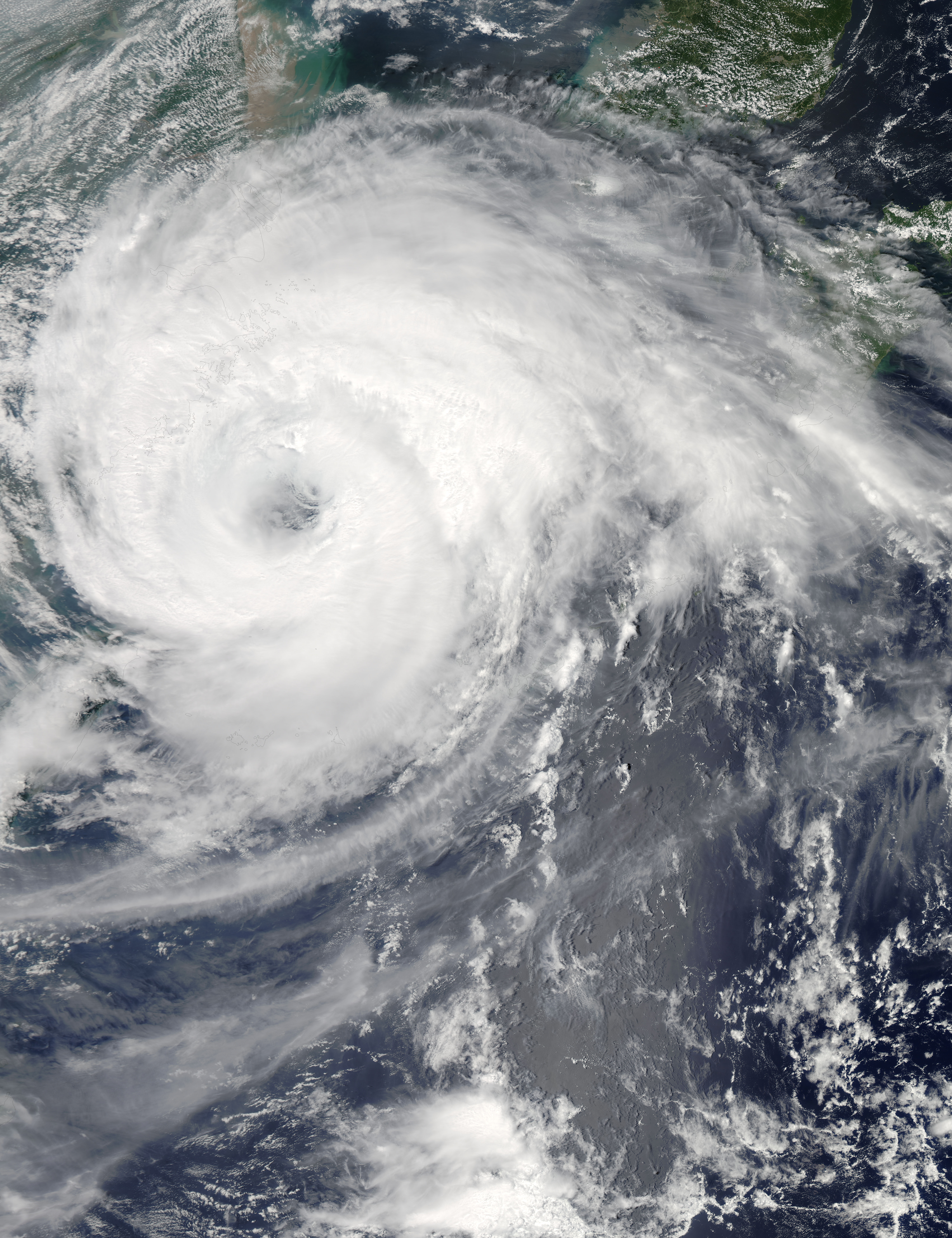
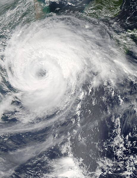
English: In early August, authorities closed schools, grounded flights, and halted passenger train travel in coastal regions of China’s Zhejiang Province, Xinhua reported. The precautions were taken in anticipation of Typhoon Haikui, expected to make landfall overnight August 7–8, 2012.
The Moderate Resolution Imaging Spectroradiometer (MODIS) on NASA’s Aqua satellite captured this natural-color image of Haikui at 12:35 p.m. local time on August 7, 2012. Haikui sported a well-defined eye, and its spiral arms extended far inland over eastern China. (This image is rotated slightly, and north is to the upper right.) On August 7, the U.S. Navy’s Joint Typhoon Warning Center (JTWC) reported that Haikui was located about 185 nautical miles (345 kilometers) northeast of Taipei. As it had the previous day, Haikui had maximum sustained winds of 65 knots (120 kilometers per hour) with gusts up to 80 knots (150 kilometers per hour). The JTWC storm track showed Haikui making landfall south of Shanghai between August 7 and 8, 2012. Haikui approached the coast of China in the wake of Damrey and Saola, severe storms that came ashore just days earlier. |
|||||
| 日期 | ||||||
| 來源 | http://rapidfire.sci.gsfc.nasa.gov/cgi-bin/imagery/single.cgi?image=Haikui.A2012220.0435.2km.jpg | |||||
| 作者 | Nasa | |||||
| 授權許可 (重用此檔案) |
Public Domain
|

檔案歷史
點選日期/時間以檢視該時間的檔案版本。
| 日期/時間 | 縮圖 | 尺寸 | 用戶 | 備註 | |
|---|---|---|---|---|---|
| 目前 | 2019年2月18日 (一) 08:16 | | 6,000 × 7,800(5.81 MB) | Nino Marakot | Overexposed (sharpened is not a good thing) |
| 2012年11月30日 (五) 08:24 |  | 6,000 × 7,800(9.98 MB) | Earth100 | User created page with UploadWizard |
檔案用途
下列2個頁面有用到此檔案:
全域檔案使用狀況
以下其他 wiki 使用了這個檔案:
- de.wikipedia.org 的使用狀況
- en.wikipedia.org 的使用狀況
- eo.wikipedia.org 的使用狀況