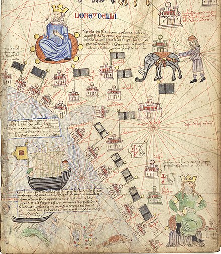
File:Delhi Sultanate Flag.svg

此 SVG 檔案的 PNG 預覽的大小:800 × 377 像素。 其他解析度:320 × 151 像素 | 640 × 302 像素 | 1,024 × 483 像素 | 1,280 × 604 像素 | 2,560 × 1,207 像素 | 2,687 × 1,267 像素。
原始檔案 (SVG 檔案,表面大小:2,687 × 1,267 像素,檔案大小:8 KB)
檔案歷史
點選日期/時間以檢視該時間的檔案版本。
| 日期/時間 | 縮圖 | 尺寸 | 用戶 | 備註 | |
|---|---|---|---|---|---|
| 目前 | 2024年4月6日 (六) 15:18 |  | 2,687 × 1,267(8 KB) | NorthTension | adding transparency |
| 2023年4月2日 (日) 12:20 |  | 2,687 × 1,267(7 KB) | पाटलिपुत्र | Reverted to version as of 11:00, 4 March 2023 (UTC) The flag in the Catalan Atlas is not green. Check description on the page | |
| 2023年4月1日 (六) 17:01 |  | 678 × 310(235位元組) | 5ysksos6 | Reverted to version as of 21:12, 3 March 2023 (UTC) | |
| 2023年3月4日 (六) 11:00 |  | 2,687 × 1,267(7 KB) | पाटलिपुत्र | Reverted to version as of 04:52, 10 February 2023 (UTC) Fake | |
| 2023年3月3日 (五) 21:12 |  | 678 × 310(235位元組) | Shylame | Reverted to version as of 02:28, 10 February 2023 (UTC) It was green in colour | |
| 2023年2月10日 (五) 04:52 |  | 2,687 × 1,267(7 KB) | पाटलिपुत्र | Reverted to version as of 06:40, 9 February 2023 (UTC) | |
| 2023年2月10日 (五) 02:28 |  | 678 × 310(235位元組) | 5ysksos6 | Reverted to version as of 15:35, 28 June 2021 (UTC), the catalan atlas is from more than 625+ years old, it can be green but decolorated | |
| 2023年2月9日 (四) 06:40 |  | 2,687 × 1,267(7 KB) | पाटलिपुत्र | borders | |
| 2023年2月9日 (四) 06:25 |  | 2,687 × 1,267(9 KB) | पाटलिपुत्र | actual flag per source | |
| 2023年2月8日 (三) 09:38 |  | 2,517 × 1,256(581位元組) | पाटलिपुत्र | Proportions |
檔案用途
全域檔案使用狀況
以下其他 wiki 使用了這個檔案:
- af.wikipedia.org 的使用狀況
- ar.wikipedia.org 的使用狀況
- سلطنة مغول الهند
- فيروز شاه تغلق
- محمد تغلق
- مماليك الهند
- سلطنة دلهي
- علم بنغلاديش
- نظام الدين أولياء
- بهمنيون
- بيبي ناناكي جي
- تغلق خان
- محمود شاه تغلق
- نصرت شاه تغلق
- خضر خان
- محمد شاه بن فريد خان
- قطب الدين الخلجي
- ناصر الدين خسرو
- بهلول اللودهي
- سكندر بن بهلول اللودهي
- مالك مقبول
- سلطنة البنغال
- قائمة الحروب 1000–1499
- قائمة أعلام باكستان
- سلطنة لاخناوتي
- معركة سينجولي
- شهاب الدين الدولت آبادي
- ary.wikipedia.org 的使用狀況
- ast.wikipedia.org 的使用狀況
- azb.wikipedia.org 的使用狀況
- az.wikipedia.org 的使用狀況
- ba.wikipedia.org 的使用狀況
- be.wikipedia.org 的使用狀況
- bg.wikipedia.org 的使用狀況
- bh.wikipedia.org 的使用狀況
- bn.wikipedia.org 的使用狀況
- মুঘল সাম্রাজ্য
- বাংলা সালতানাত
- মামলুক সালতানাত (দিল্লি)
- বাংলাদেশী পতাকার তালিকা
- বাংলাদেশ সংশ্লিষ্ট সংঘটিত যুদ্ধের তালিকা
- ব্যবহারকারী:Ahm masum/খেলাঘর16
- মালওয়া সালতানাত
- গুজরাত সালতানাত
- আর্কট রাজ্য
- বাংলা সালতানাত–দিল্লি সালতানাত যুদ্ধ
- বখতিয়ার খলজীর তিব্বত অভিযান
- বাংলায় দিল্লির আক্রমণ (১৩৫৮–১৩৬০)
- সেউণ (যাদব) রাজবংশ
- পরমার রাজবংশ
檢視此檔案的更多全域使用狀況。


