
File:Burgess Shale, Yoho National Park of Canada.jpg
預覽大小:600 × 600 像素。 其他解析度:240 × 240 像素 | 480 × 480 像素 | 768 × 768 像素 | 1,024 × 1,024 像素 | 2,400 × 2,400 像素。
原始檔案 (2,400 × 2,400 像素,檔案大小:3.44 MB,MIME 類型:image/jpeg)
摘要
| 描述 |
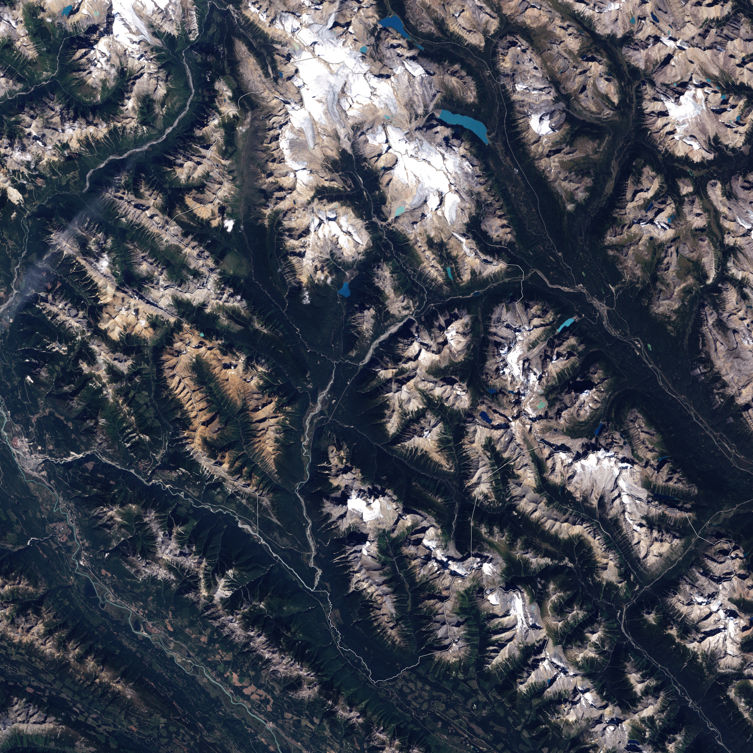
English: This is a true-colour image of the area in British Columbia’s Yoho National Park in which the Burgess Shale Formation is cropping out. This formation is renowned for its abundance of well-preserved Cambrian fossils. The formation is part of the bedrock of a landscape of naked ridges, forested slopes, meandering rivers, and jewel-toned lakes. The Sun is shining from the south-east, and the rugged mountains of the park cast shadows to the north-west. The fossil sites are located approximately in the center of the image on the mountains that are flanking the valley of the Kicking Horse River Image created using Landsat data provided by the United States Geological Survey. Instrument: Landsat 7 - ETM+. |
| 日期 | |
| 來源 | NASA Earth Observatory |
| 作者 | Jesse Allen |
| 其他版本 |
.jpg)
授權條款
| 本作品由NASA創作,屬於公有領域。根據NASA的版權政策:“NASA的創作除非另有聲明否則不受版權保護。”(參見:Template:PD-USGov/zh,NASA版權政策或JPL圖像使用政策) | ||
 |
警告:
|
| 註解 | 該圖片含有註解:在維基媒體共享資源上查看註解 |
檔案歷史
點選日期/時間以檢視該時間的檔案版本。
| 日期/時間 | 縮圖 | 尺寸 | 用戶 | 備註 | |
|---|---|---|---|---|---|
| 目前 | 2009年8月23日 (日) 09:00 | | 2,400 × 2,400(3.44 MB) | Originalwana | {{Information |Description={{en|1=This is a true-colour image of Burgess Shale quarry in British Columbia’s Yoho National Park. The quarry sits in a landscape of naked ridges, forested slopes, meandering rivers, and jewel-toned lakes. The Sun is shining |
檔案用途
下列頁面有用到此檔案:
全域檔案使用狀況
以下其他 wiki 使用了這個檔案:
- ar.wikipedia.org 的使用狀況
- de.wikipedia.org 的使用狀況
- en.wikipedia.org 的使用狀況
- he.wikipedia.org 的使用狀況