
File:Whiteseamap.jpg
預覽大小:699 × 599 像素。 其他解析度:280 × 240 像素 | 560 × 480 像素 | 896 × 768 像素 | 1,195 × 1,024 像素 | 1,478 × 1,267 像素。
原始檔案 (1,478 × 1,267 像素,檔案大小:370 KB,MIME 類型:image/jpeg)
| 描述 |
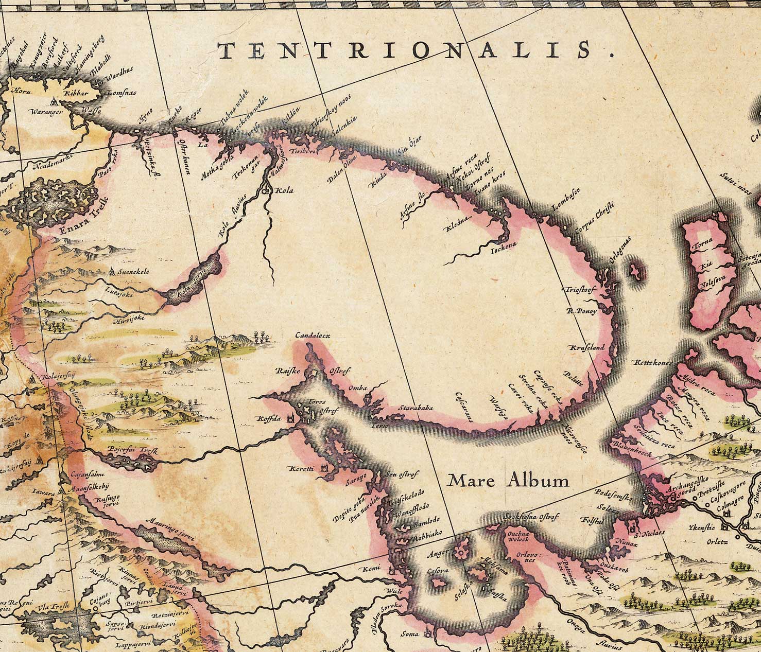
English: Map of the White Sea and adjacent regions. From the Dutch "Novus Atlas" (1635). Cartographer: Willem Janszoon Blaeu. |
|||||||||||
| 來源 | http://biarmia.narod.ru/17.html Transferred from en.wikipedia to Commons by Hardscarf using CommonsHelper. | |||||||||||
| 作者 | ||||||||||||
| 授權許可 (重用此檔案) |
|
|||||||||||


原始上傳日誌
The original description page was here. All following user names refer to en.wikipedia.
- 2007-06-19 16:59 Ghirlandajo 1478×1267× (379069 bytes) Map of the [[White Sea]] and adjacent regions. From the Dutch "Novus Atlas" (1635). Cartographer: Willem Janszoon Blaeu. {{PD-art}} Source: http://biarmia.narod.ru/17.html
檔案歷史
點選日期/時間以檢視該時間的檔案版本。
| 日期/時間 | 縮圖 | 尺寸 | 用戶 | 備註 | |
|---|---|---|---|---|---|
| 目前 | 2009年12月2日 (三) 11:00 | | 1,478 × 1,267(370 KB) | File Upload Bot (Magnus Manske) | {{BotMoveToCommons|en.wikipedia|year={{subst:CURRENTYEAR}}|month={{subst:CURRENTMONTHNAME}}|day={{subst:CURRENTDAY}}}} {{Information |Description={{en|Map of the en:White Sea and adjacent regions. From the Dutch "Novus Atlas" (1635). Cartographer: |
檔案用途
下列頁面有用到此檔案:
全域檔案使用狀況
以下其他 wiki 使用了這個檔案:
- ar.wikipedia.org 的使用狀況
- ca.wikipedia.org 的使用狀況
- cs.wikipedia.org 的使用狀況
- de.wikipedia.org 的使用狀況
- en.wikipedia.org 的使用狀況
- es.wikipedia.org 的使用狀況
- fa.wikipedia.org 的使用狀況
- fi.wikipedia.org 的使用狀況
- frr.wikipedia.org 的使用狀況
- hr.wikipedia.org 的使用狀況
- la.wikipedia.org 的使用狀況
- mt.wikipedia.org 的使用狀況
- nl.wikipedia.org 的使用狀況
- no.wikipedia.org 的使用狀況
- ru.wikipedia.org 的使用狀況
- sr.wikipedia.org 的使用狀況
- ta.wikipedia.org 的使用狀況
- te.wikipedia.org 的使用狀況
- uk.wikipedia.org 的使用狀況
- vi.wikipedia.org 的使用狀況