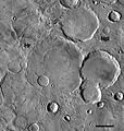
File:Ridged Plains Overlying Noachian.jpg

預覽大小:570 × 599 像素。 其他解析度:228 × 240 像素 | 457 × 480 像素。
原始檔案 (800 × 841 像素,檔案大小:166 KB,MIME 類型:image/jpeg)
檔案歷史
點選日期/時間以檢視該時間的檔案版本。
| 日期/時間 | 縮圖 | 尺寸 | 用戶 | 備註 | |
|---|---|---|---|---|---|
| 目前 | 2013年1月30日 (三) 15:15 |  | 800 × 841(166 KB) | Szczureq | {{Information |Description={{en|THEMIS IR Daytime Mosaic of ridged plains in eastern Hesperia Planum}} |Source=Transferred from [http://en.wikipedia.org en.wikipedia]<br/> (Original text : ''JMARS: http://jmars.asu.edu/'') |Date=16:03, 18 June 2011 (UT... |
檔案用途
全域檔案使用狀況
以下其他 wiki 使用了這個檔案:
- ar.wikipedia.org 的使用狀況
- en.wikipedia.org 的使用狀況
- es.wikipedia.org 的使用狀況
- pl.wikipedia.org 的使用狀況
- ru.wikipedia.org 的使用狀況
- uk.wikipedia.org 的使用狀況
- www.wikidata.org 的使用狀況


