
File:Ionian Islands.svg

此 SVG 檔案的 PNG 預覽的大小:532 × 547 像素。 其他解析度:233 × 240 像素 | 467 × 480 像素 | 747 × 768 像素 | 996 × 1,024 像素 | 1,992 × 2,048 像素。
原始檔案 (SVG 檔案,表面大小:532 × 547 像素,檔案大小:281 KB)

|
This map has been uploaded by Electionworld from en.wikipedia.org to enable the |
摘要
| 描述 |
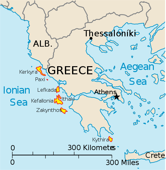
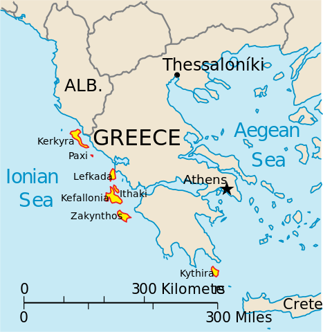
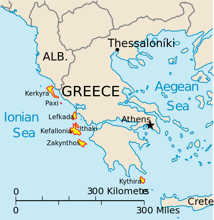
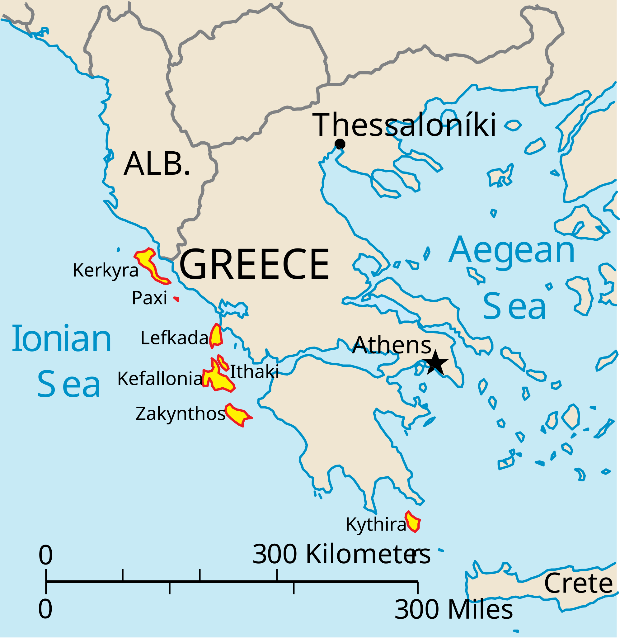
English: Map of the Ionian Islands off Greece. |
| 日期 | |
| 來源 | 自己的作品, Original vector data taken from the 2006 CIA World Factbook map of Europe. All modifications were made by me, and are free for anyone to use for any purpose. |
| 作者 | Electionworld |
| 其他版本 |
Version en français : |
授權條款
|
|
 |
檔案歷史
點選日期/時間以檢視該時間的檔案版本。
| 日期/時間 | 縮圖 | 尺寸 | 用戶 | 備註 | |
|---|---|---|---|---|---|
| 目前 | 2010年4月4日 (日) 14:39 | | 532 × 547(281 KB) | Kmusser | rm Macedonia label, not important to the map and avoids POV issue |
| 2006年12月20日 (三) 20:17 |  | 532 × 547(258 KB) | Electionworld | {{ew|en|IMeowbot}} == Summary == Map of the Ionian Islands off Greece. Original vector data taken from the 2006 CIA World Factbook map of Europe. All modifications were made by me, and are free for anyone to use for any purpose. == Licensing == {{PD-US |
檔案用途
下列15個頁面有用到此檔案:
全域檔案使用狀況
以下其他 wiki 使用了這個檔案:
- ar.wikipedia.org 的使用狀況
- ast.wikipedia.org 的使用狀況
- be.wikipedia.org 的使用狀況
- bg.wikipedia.org 的使用狀況
- ceb.wikipedia.org 的使用狀況
- ce.wikipedia.org 的使用狀況
- cy.wikipedia.org 的使用狀況
- da.wikipedia.org 的使用狀況
- de.wikipedia.org 的使用狀況
- en.wikipedia.org 的使用狀況
- et.wikipedia.org 的使用狀況
- fa.wikipedia.org 的使用狀況
- fi.wikipedia.org 的使用狀況
- fr.wikipedia.org 的使用狀況
- he.wikipedia.org 的使用狀況
- hr.wikipedia.org 的使用狀況
- hu.wikipedia.org 的使用狀況
- hyw.wikipedia.org 的使用狀況
- id.wikipedia.org 的使用狀況
- it.wikipedia.org 的使用狀況
檢視此檔案的更多全域使用狀況。