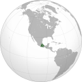
File:Aztec Empire (orthographic projection).svg

此 SVG 檔案的 PNG 預覽的大小:550 × 550 像素。 其他解析度:240 × 240 像素 | 480 × 480 像素 | 768 × 768 像素 | 1,024 × 1,024 像素 | 2,048 × 2,048 像素。
原始檔案 (SVG 檔案,表面大小:550 × 550 像素,檔案大小:102 KB)
檔案歷史
點選日期/時間以檢視該時間的檔案版本。
| 日期/時間 | 縮圖 | 尺寸 | 用戶 | 備註 | |
|---|---|---|---|---|---|
| 目前 | 2013年4月24日 (三) 07:24 |  | 550 × 550(102 KB) | El Comandante | Reverted to version as of 20:52, 23 April 2013 : Giggette's POV still undocumented |
| 2013年4月23日 (二) 21:12 |  | 550 × 550(278 KB) | Giggette | This is not a map of the provinces tributary of the triple alliance | |
| 2013年4月23日 (二) 20:52 |  | 550 × 550(102 KB) | El Comandante | Reverted to version as of 12:23, 11 February 2010 | |
| 2013年4月23日 (二) 20:52 |  | 550 × 550(102 KB) | El Comandante | Reverted to version as of 08:30, 20 April 2013 | |
| 2013年4月23日 (二) 20:49 |  | 550 × 550(102 KB) | El Comandante | Reverted to version as of 08:30, 20 April 2013 : still no reliable source to support the other map | |
| 2013年4月23日 (二) 00:29 |  | 550 × 550(278 KB) | Giggette | Reverted to version as of 16:07, 19 April 2013 | |
| 2013年4月23日 (二) 00:27 |  | 550 × 550(278 KB) | Giggette | it wasn't my version but before upload another version use the discussion page | |
| 2013年4月20日 (六) 08:30 |  | 550 × 550(102 KB) | El Comandante | Reverted to version as of 10:58, 19 April 2013 : no reliable source supports the Giggette's version | |
| 2013年4月19日 (五) 16:07 |  | 550 × 550(278 KB) | Giggette | reverted to original version on 10 January 2010 | |
| 2013年4月19日 (五) 10:58 |  | 550 × 550(102 KB) | El Comandante | No reliable source to support the version proposed by Giggette VS a very reliable source to support this version |
檔案用途
下列頁面有用到此檔案:
全域檔案使用狀況
以下其他 wiki 使用了這個檔案:
- ar.wikipedia.org 的使用狀況
- ast.wikipedia.org 的使用狀況
- azb.wikipedia.org 的使用狀況
- az.wikipedia.org 的使用狀況
- ba.wikipedia.org 的使用狀況
- bn.wikipedia.org 的使用狀況
- ca.wikipedia.org 的使用狀況
- cs.wikipedia.org 的使用狀況
- cv.wikipedia.org 的使用狀況
- en.wikipedia.org 的使用狀況
- es.wikipedia.org 的使用狀況
- eu.wikipedia.org 的使用狀況
- fa.wikipedia.org 的使用狀況
- fr.wikipedia.org 的使用狀況
- gd.wikipedia.org 的使用狀況
- gl.wikipedia.org 的使用狀況
- he.wikipedia.org 的使用狀況
- ht.wikipedia.org 的使用狀況
- hy.wikipedia.org 的使用狀況
- id.wikipedia.org 的使用狀況
- incubator.wikimedia.org 的使用狀況
- it.wikipedia.org 的使用狀況
- ja.wikipedia.org 的使用狀況
- kbd.wikipedia.org 的使用狀況
- kn.wikipedia.org 的使用狀況
- ko.wikipedia.org 的使用狀況
- mr.wikipedia.org 的使用狀況
- mt.wikipedia.org 的使用狀況
- nah.wikipedia.org 的使用狀況
- no.wikipedia.org 的使用狀況
- oc.wikipedia.org 的使用狀況
- pt.wikipedia.org 的使用狀況
- ru.wikipedia.org 的使用狀況
- simple.wikipedia.org 的使用狀況
- sk.wikipedia.org 的使用狀況
- ta.wikipedia.org 的使用狀況
- th.wikipedia.org 的使用狀況
- tt.wikipedia.org 的使用狀況
檢視此檔案的更多全域使用狀況。


