
File:Sardar Sarovar Dam 2006, India.jpg
預覽大小:800 × 600 像素。 其他解析度:320 × 240 像素 | 640 × 480 像素 | 1,024 × 768 像素 | 1,280 × 960 像素 | 2,048 × 1,536 像素。
原始檔案 (2,048 × 1,536 像素,檔案大小:1.38 MB,MIME 類型:image/jpeg)
摘要
| 描述 |
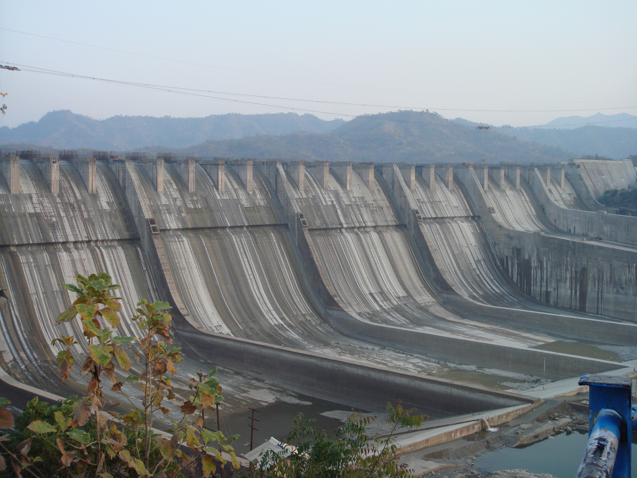
English: A photograph of the Sardar Sarovar Dam on the River Narmada, India, showing the principal spillway and construction underway for increasing the height from 110.64 metres to 121.92 as per clearance granted in March 2006. |
| 日期 | |
| 來源 | 自己的作品 |
| 作者 | AceFighter19 |
| 拍攝地點 | | 位於此地的本圖片與其他圖片: OpenStreetMap |
|---|
授權條款
| 我,此作品的版權所有人,釋出此作品至公共領域。此授權條款在全世界均適用。 這可能在某些國家不合法,如果是的話: 我授予任何人有權利使用此作品於任何用途,除受法律約束外,不受任何限制。 |
檔案歷史
點選日期/時間以檢視該時間的檔案版本。
| 日期/時間 | 縮圖 | 尺寸 | 使用者 | 備註 | |
|---|---|---|---|---|---|
| 目前 | 2009年6月8日 (一) 19:17 | | 2,048 × 1,536(1.38 MB) | AceFighter19 | {{Information |Description={{en|1=A photograph of the Sardar Sarovar Dam on the River Narmada, India, showing the principal spillway and construction underway for increasing the height from 110.64 metres to 121.92 as per clearance granted in March 2006.}} |
檔案用途
下列頁面有用到此檔案:
全域檔案使用狀況
以下其他 wiki 使用了這個檔案:
- bn.wikipedia.org 的使用狀況
- en.wikipedia.org 的使用狀況
- es.wikipedia.org 的使用狀況
- fr.wikipedia.org 的使用狀況
- gu.wikipedia.org 的使用狀況
- he.wikipedia.org 的使用狀況
- hi.wikipedia.org 的使用狀況
- hy.wikipedia.org 的使用狀況
- it.wikipedia.org 的使用狀況
- pt.wikipedia.org 的使用狀況
- ru.wikipedia.org 的使用狀況
- rw.wikipedia.org 的使用狀況
- tg.wikipedia.org 的使用狀況