
File:SNK MAP I 1000W.jpg
預覽大小:800 × 557 像素。 其他解析度:320 × 223 像素 | 640 × 446 像素 | 1,024 × 713 像素 | 1,280 × 892 像素 | 1,556 × 1,084 像素。
原始檔案 (1,556 × 1,084 像素,檔案大小:250 KB,MIME 類型:image/jpeg)
摘要
| 描述 |
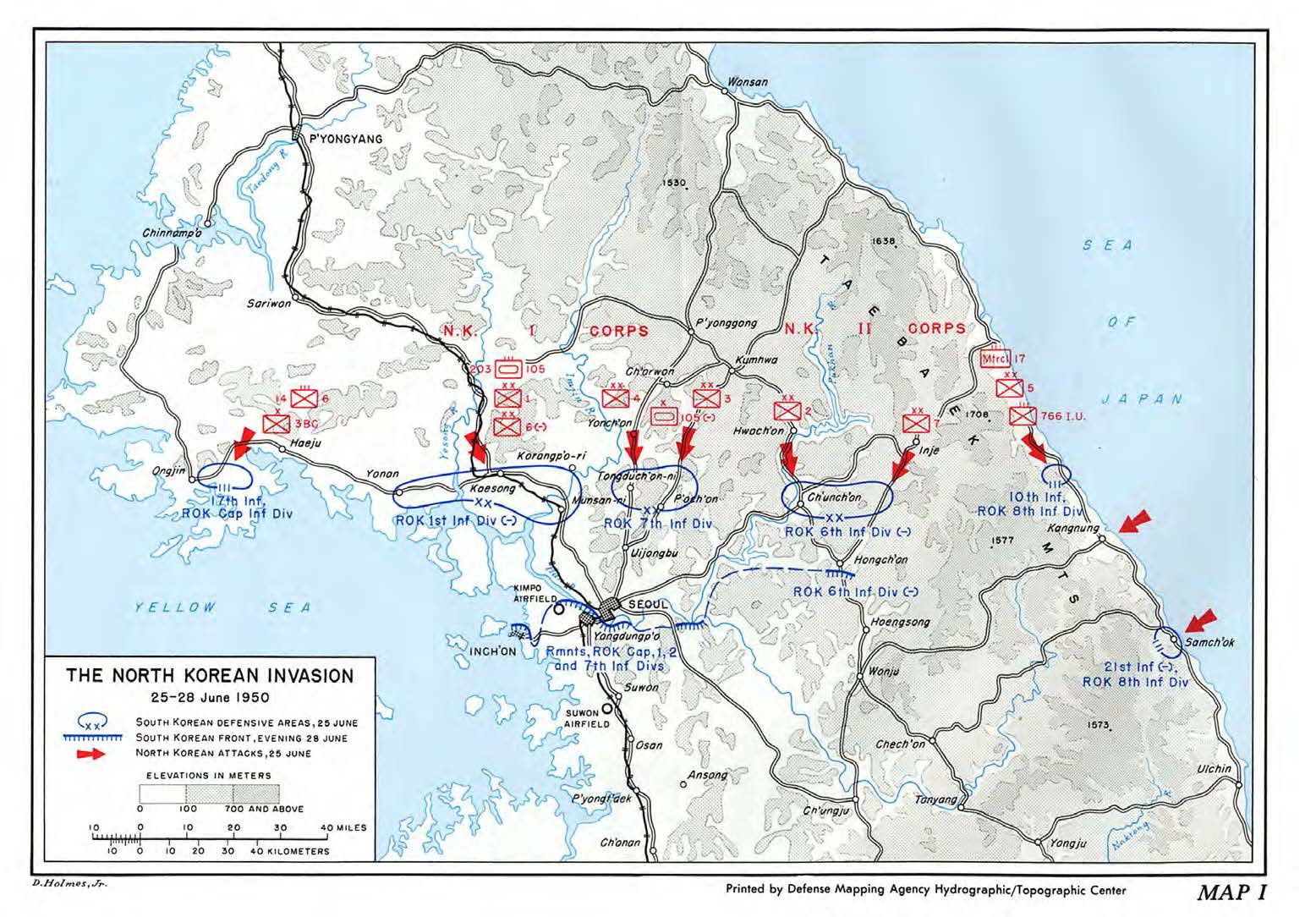
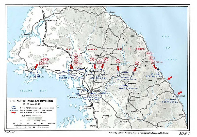
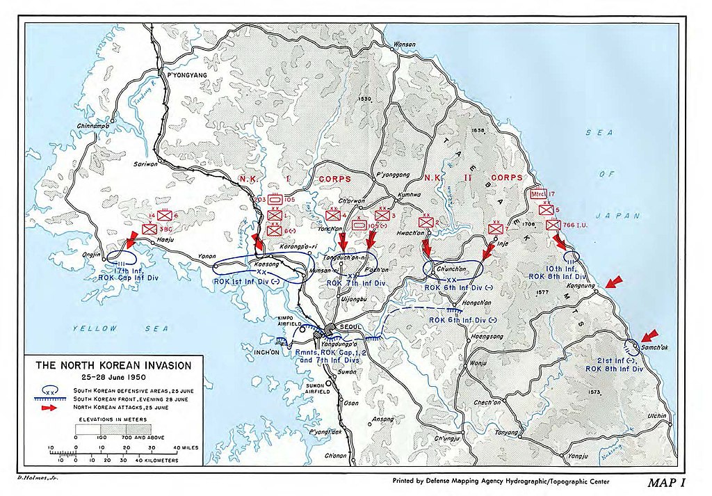
English: Map of the North Korean Invasion, 25-28 June 1950 |
| 日期 | |
| 來源 | South To The Naktong, North To The Yalu - The United States Army in the Korean War, Center of Military History, United States Army, Washington, D.C. |
| 作者 | Roy E. Appleman |
授權條款
| This image is in the public domain because it contains materials that originally came from the United States Army Center of Military History, subject to the following qualification.
Note: The images of all badges, insignia, decorations and medals on the "CMH Online" web site are produced by the United States Army Institute of Heraldry and protected by Title 18, United States Code, Section 704 and the Code of Federal Regulations (32 CFR, Part 507). Permission to use these images for commercial purposes must be obtained from The Institute of Heraldry prior to their use. |

|
檔案歷史
點選日期/時間以檢視該時間的檔案版本。
| 日期/時間 | 縮圖 | 尺寸 | 使用者 | 備註 | |
|---|---|---|---|---|---|
| 目前 | 2020年12月28日 (一) 22:26 | | 1,556 × 1,084(250 KB) | Charles Shaulis | Uploaded a work by D. Holmes, Jr. from Reference: South To The Naktong, North To The Yalu - The United States Army in the Korean War, Center of Military History, United States Army, Washington, D.C. with UploadWizard |
檔案用途
下列頁面有用到此檔案:
全域檔案使用狀況
以下其他 wiki 使用了這個檔案:
- en.wikipedia.org 的使用狀況
- ko.wikipedia.org 的使用狀況
- my.wikipedia.org 的使用狀況