
File:Rhus typhina range map 4.png

預覽大小:799 × 599 像素。 其他解析度:320 × 240 像素 | 640 × 480 像素 | 1,024 × 768 像素 | 1,280 × 960 像素 | 2,560 × 1,920 像素 | 3,854 × 2,891 像素。
原始檔案 (3,854 × 2,891 像素,檔案大小:243 KB,MIME 類型:image/png)
摘要
| 描述 |
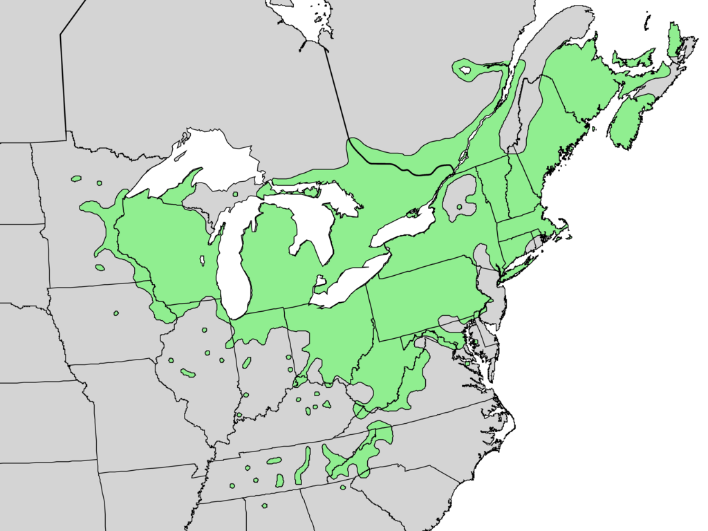
English: Range map of Rhus typhina — native to the Eastern U.S. |
| 日期 | |
| 來源 | Digital representation of "Atlas of United States Trees" by Elbert L. Little, Jr. [1] |
| 作者 | U.S. Geological Survey |
授權條款
|
|
原始上傳日誌
Transferred from en.wikipedia to Commons by Pinethicket using CommonsHelper.
The original description page was here. All following user names refer to en.wikipedia.
- 2010-05-21 16:37 Masebrock 831×676× (162804 bytes) {{Information |Description=Range map of Rhus typhina |Source=Digital representation of "Atlas of United States Trees" by Elbert L. Little, Jr. [http://esp.cr.usgs.gov/data/atlas/little/] |Date=1999 |Author=U.S. Geological Survey |Permission={{PD-USGov-Int
檔案歷史
點選日期/時間以檢視該時間的檔案版本。
| 日期/時間 | 縮圖 | 尺寸 | 使用者 | 備註 | |
|---|---|---|---|---|---|
| 目前 | 2013年12月20日 (五) 20:15 | | 3,854 × 2,891(243 KB) | Nonenmac | no striping, higher resolution, white lakes, province borders added |
| 2012年10月22日 (一) 20:48 |  | 831 × 676(159 KB) | File Upload Bot (Magnus Manske) | Transfered from en.wikipedia by User:Pinethicket using CommonsHelper |
檔案用途
下列頁面有用到此檔案:
全域檔案使用狀況
以下其他 wiki 使用了這個檔案:
- ceb.wikipedia.org 的使用狀況
- cy.wikipedia.org 的使用狀況
- de.wikipedia.org 的使用狀況
- en.wikipedia.org 的使用狀況
- eo.wikipedia.org 的使用狀況
- et.wikipedia.org 的使用狀況
- fa.wikipedia.org 的使用狀況
- fr.wikipedia.org 的使用狀況
- hu.wikipedia.org 的使用狀況
- lt.wikipedia.org 的使用狀況
- lv.wikipedia.org 的使用狀況
- no.wikipedia.org 的使用狀況
- ro.wikipedia.org 的使用狀況
- ru.wikipedia.org 的使用狀況
- sl.wikipedia.org 的使用狀況
- sr.wikipedia.org 的使用狀況
- uk.wikipedia.org 的使用狀況
- uz.wikipedia.org 的使用狀況
- vi.wikipedia.org 的使用狀況