
File:PIA16236-MarsCuriosityRover-EtThenRock-20121029.jpg

原始檔案 (1,196 × 1,605 像素,檔案大小:2.51 MB,MIME 類型:image/jpeg)
摘要
| 描述 |
English: 10.29.2012
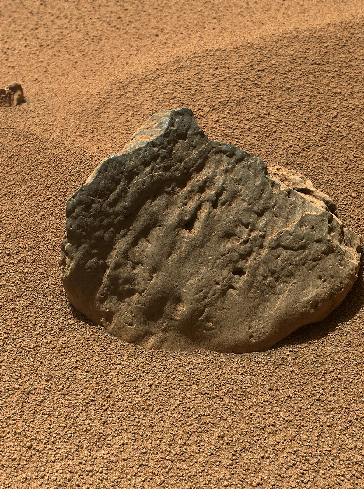
Rock 'Et-Then' Near Curiosity, Sol 82 http://photojournal.jpl.nasa.gov/catalog/PIA16236 The Mars Hand Lens Imager (MAHLI) on the arm of NASA's Mars rover Curiosity took this image of a rock called "Et-Then" during the mission's 82nd sol, or Martian day (Oct. 29, 2012.) The rock's informal name comes from the name of an island in Great Slave Lake, Northwest Territories, Canada. MAHLI viewed the rock from a distance of about 15.8 inches (40 centimeters). The image covers an area about 9.5 inches by 7 inches (24 centimeters by 18 centimeters). Et-Then is located near the rover's front left wheel, where the rover has been stationed while scooping soil at the site called "Rocknest." This is one of three images acquired by MAHLI from slightly different positions so that a three-dimensional information could be used to plan possible future examination of the rock. Image Credit: NASA/JPL-Caltech/MSSS |
| 日期 | |
| 來源 | http://photojournal.jpl.nasa.gov/jpeg/PIA16236.jpg |
| 作者 | NASA/JPL-Caltech/MSSS |
授權條款
| 本作品由NASA創作,屬於公有領域。根據NASA的版權政策:“NASA的創作除非另有聲明否則不受版權保護。”(參見:Template:PD-USGov/zh,NASA版權政策或JPL圖像使用政策) | ||
 |
警告:
|
檔案歷史
點選日期/時間以檢視該時間的檔案版本。
| 日期/時間 | 縮圖 | 尺寸 | 使用者 | 備註 | |
|---|---|---|---|---|---|
| 目前 | 2019年1月10日 (四) 17:16 | | 1,196 × 1,605(2.51 MB) | Kesäperuna | 100% JPEG quality from full quality TIFF. |
| 2012年10月30日 (二) 13:51 |  | 1,196 × 1,605(651 KB) | Drbogdan | User created page with UploadWizard |
檔案用途
全域檔案使用狀況
以下其他 wiki 使用了這個檔案:
- ar.wikipedia.org 的使用狀況
- de.wikipedia.org 的使用狀況
- en.wikipedia.org 的使用狀況
- es.wikipedia.org 的使用狀況
- lb.wikipedia.org 的使用狀況
- pl.wikipedia.org 的使用狀況
- ru.wikipedia.org 的使用狀況
- sr.wikipedia.org 的使用狀況
- uk.wikipedia.org 的使用狀況
- vi.wikipedia.org 的使用狀況