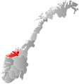
File:Norway Counties Møre og Romsdal Position.svg
外观

此SVG文件的PNG预览的大小:562 × 600像素。 其他分辨率:225 × 240像素 | 450 × 480像素 | 719 × 768像素 | 959 × 1,024像素 | 1,918 × 2,048像素 | 740 × 790像素。
原始文件 (SVG文件,尺寸为740 × 790像素,文件大小:54 KB)
文件历史
点击某个日期/时间查看对应时刻的文件。
| 日期/时间 | 缩略图 | 大小 | 用户 | 备注 | |
|---|---|---|---|---|---|
| 当前 | 2024年1月2日 (二) 00:47 |  | 740 × 790(54 KB) | Jay1279 | update county borders for 2024 |
| 2020年1月1日 (三) 22:41 |  | 740 × 790(51 KB) | Bjarkan | Border update for 2020. | |
| 2019年1月27日 (日) 08:26 |  | 740 × 790(67 KB) | Bjarkan | Border update (Rindal). | |
| 2017年12月17日 (日) 03:05 |  | 740 × 790(67 KB) | Bjarkan | Improved version. | |
| 2013年4月12日 (五) 23:46 |  | 562 × 600(77 KB) | Jay1279 | Re-upload the updated File:Norway Counties MøreogRomsdal Position.svg by User:Fleinn. Original filename does not work with Template:Infobox kommune, so this filename must be used. | |
| 2013年1月3日 (四) 22:57 |  | 512 × 512(80 KB) | Choihei | {{Information |Description={{en|Re-upload of en:User:Marmelad's Møre og Romsdal map so that it can be used in templates on en:Møre og Romsdal, en:Kristiansund, etc.}} |Source=Transferred from [http://en.wikipedia.org en.wikipedia] |... |
文件用途
以下页面使用本文件:
全域文件用途
以下其他wiki使用此文件:
- af.wikipedia.org上的用途
- ang.wikipedia.org上的用途
- ast.wikipedia.org上的用途
- azb.wikipedia.org上的用途
- bat-smg.wikipedia.org上的用途
- bpy.wikipedia.org上的用途
- br.wikipedia.org上的用途
- bs.wikipedia.org上的用途
- da.wikipedia.org上的用途
- de.wikipedia.org上的用途
- en.wikipedia.org上的用途
- Kristiansund
- Molde
- Sunndal
- Surnadal
- Halsa
- Tustna
- Smøla
- Vanylven
- Sande, Møre og Romsdal
- Herøy, Møre og Romsdal
- Ulstein
- Hareid
- Volda
- Ørsta
- Ørskog
- Norddal
- Stranda
- Stordal
- Sykkylven
- Skodje
- Giske
- Haram, Norway
- Vestnes
- Rauma, Norway
- Nesset
- Midsund
- Sandøy
- Aukra
- Fræna
- Eide
- Averøy
- Frei
- Gjemnes
- Tingvoll
- Aure, Norway
- Sula, Møre og Romsdal
- Tresfjord
- Dalsfjord, Møre og Romsdal
- Voll, Møre og Romsdal
- Eid, Møre og Romsdal
查看此文件的更多全域用途。

