
File:How satellite radar altimetry works (16980176380).jpg
本预览的尺寸:797 × 600像素。 其他分辨率:319 × 240像素 | 638 × 480像素 | 904 × 680像素。
原始文件 (904 × 680像素,文件大小:168 KB,MIME类型:image/jpeg)
.jpg?uselang=zh-cn)
.jpg?uselang=zh-cn)
.jpg?action=history&uselang=zh-cn)
.jpg)
摘要
| 描述 |
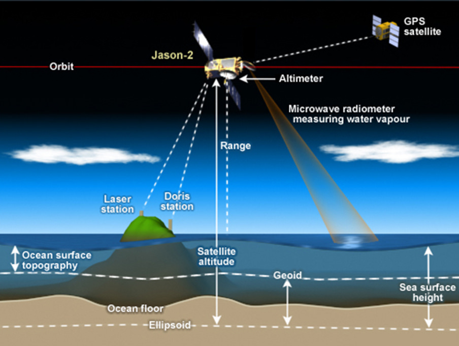
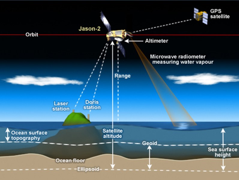
How satellite radar altimetry works Satellite radar altimeters measure the ocean surface height (sea level) by measuring the time it takes a radar pulse to make a round-trip from the satellite to the sea surface and back.
|
| 日期 | |
| 来源 | How satellite radar altimetry works |
| 作者 | NOAA Satellites |
许可协议
本图像属于公有领域,因该作品最初来自于美国国家海洋和大气管理局职员的职务作品。
|
| This image, originally posted to Flickr, was reviewed on 2 August 2016 by the administrator or reviewer Amitie 10g, who confirmed that it was available on Flickr under the stated license on that date. |
文件历史
点击某个日期/时间查看对应时刻的文件。
| 日期/时间 | 缩略图 | 大小 | 用户 | 备注 | |
|---|---|---|---|---|---|
| 当前 | 2016年7月17日 (日) 12:24 | | 904 × 680(168 KB) | Pline | Transferred from Flickr via Flickr2Commons |
.jpg)