
File:Golfe Saint-Laurent Depths fr.svg

此SVG文件的PNG预览的大小:627 × 599像素。 其他分辨率:251 × 240像素 | 502 × 480像素 | 803 × 768像素 | 1,071 × 1,024像素 | 2,143 × 2,048像素 | 1,655 × 1,582像素。
原始文件 (SVG文件,尺寸为1,655 × 1,582像素,文件大小:3.05 MB)
摘要
| 描述 |
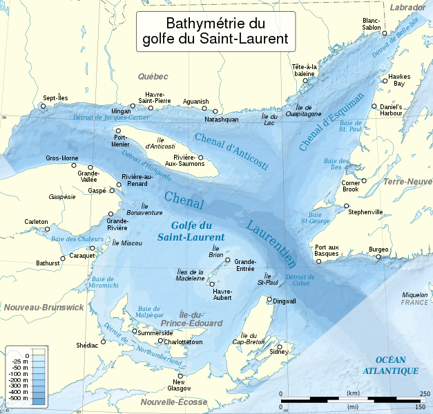
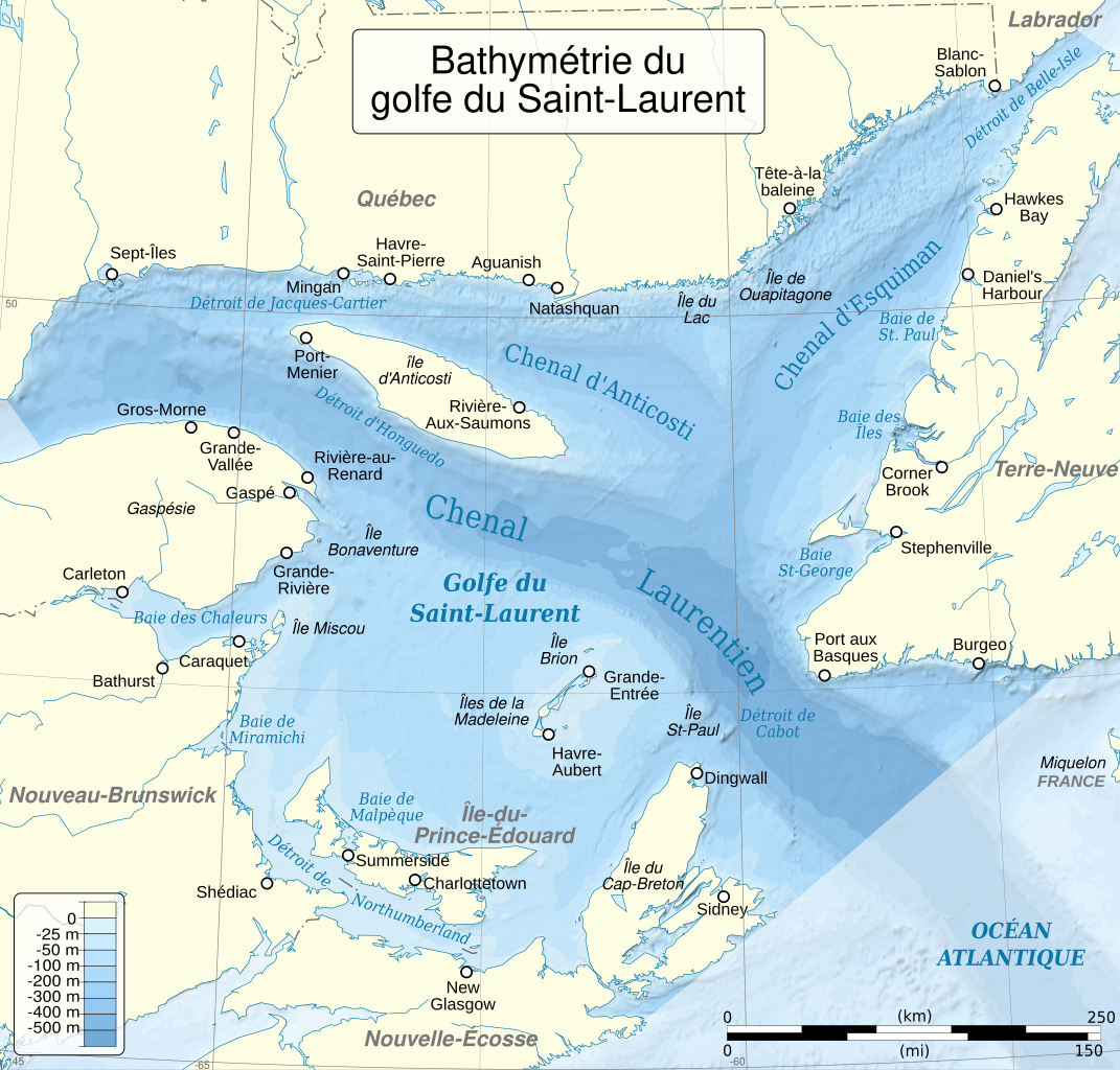
English: Depths/bathymetry of the Saint Lawrence Gulf. Cartographic data :
Français : Profondeurs/bathymétrie du golfe du Saint-Laurent. Données cartographiques :
|
||
| 日期 | |||
| 来源 |
English: Source :
|
||
| 作者 |
|
||
| 其他版本 |
Derivative works of this file: Old Harry oil field location map-fr.svg | ||
| 署名 (由许可协议要求) | © Ewan ar Born & Sémhur / Wikimedia Commons / | ||
| SVG | W3C-validity not checked.
|
||
| Graphic Lab |


| 相机位置 | | 在以下服务上查看本图像和附近其他图像: OpenStreetMap |
|---|
许可协议
我,本作品著作权人,特此采用以下许可协议发表本作品:
本文件采用知识共享署名-相同方式共享 3.0 未本地化版本许可协议授权。
- 您可以自由地:
- 共享 – 复制、发行并传播本作品
- 修改 – 改编作品
- 惟须遵守下列条件:
- 署名 – 您必须对作品进行署名,提供授权条款的链接,并说明是否对原始内容进行了更改。您可以用任何合理的方式来署名,但不得以任何方式表明许可人认可您或您的使用。
- 相同方式共享 – 如果您再混合、转换或者基于本作品进行创作,您必须以与原先许可协议相同或相兼容的许可协议分发您贡献的作品。

|
已授权您依据自由软件基金会发行的无固定段落及封面封底文字(Invariant Sections, Front-Cover Texts, and Back-Cover Texts)的GNU自由文件许可协议1.2版或任意后续版本的条款,复制、传播和/或修改本文件。该协议的副本请见“GNU Free Documentation License”。 |
您可以选择您需要的许可协议。
文件历史
点击某个日期/时间查看对应时刻的文件。
| 日期/时间 | 缩略图 | 大小 | 用户 | 备注 | |
|---|---|---|---|---|---|
| 当前 | 2014年5月26日 (一) 15:31 | | 1,655 × 1,582(3.05 MB) | Sémhur | Valid SVG |
| 2012年3月5日 (一) 21:33 |  | 1,655 × 1,582(3.05 MB) | Sémhur | Le bug du 512 px... ah y avait longtemps tiens ! | |
| 2012年3月5日 (一) 21:30 |  | 512 × 489(3.05 MB) | Sémhur | New version, with correct bathymetric contours. | |
| 2008年6月29日 (日) 19:11 |  | 920 × 710(1.03 MB) | Hektor | Cajou cajou pouet pouet |
文件用途
以下页面使用本文件:
全域文件用途
以下其他wiki使用此文件:
- af.wikipedia.org上的用途
- br.wikipedia.org上的用途
- de.wikipedia.org上的用途
- en.wikipedia.org上的用途
- es.wikipedia.org上的用途
- fr.wikipedia.org上的用途
- Golfe du Saint-Laurent
- Îles de la Madeleine
- Utilisateur:Ewan ar Born/Graphisme
- Wikipédia:Atelier graphique/Cartes/Archives/juillet 2008
- Wikipédia:Atelier graphique/Cartes/Archives/mars 2012
- Chenal Laurentien
- Frontières de l'Acadie
- Mer de Goldthwait
- Blocus du Saint-Laurent
- Catégorie:Système hydrologique du golfe du Saint-Laurent
- gl.wikipedia.org上的用途
- hr.wikipedia.org上的用途
- hy.wikipedia.org上的用途
- nl.wikipedia.org上的用途
- sr.wikipedia.org上的用途
- tr.wikipedia.org上的用途
- www.wikidata.org上的用途