
File:Zealandia, topographic map.jpg

本预览的尺寸:529 × 600像素。 其他分辨率:212 × 240像素 | 423 × 480像素 | 678 × 768像素 | 903 × 1,024像素 | 1,500 × 1,700像素。
原始文件 (1,500 × 1,700像素,文件大小:4.57 MB,MIME类型:image/jpeg)
摘要
| 描述 |
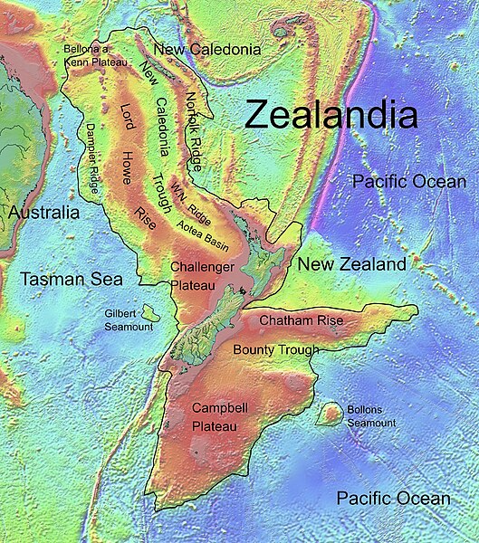
Deutsch: Die topografische Karte von Zealandia basiert auf den Bathymetrie-Daten des Scripps Institution of Oceanography, University of California, San Diego.
Die Umrandung zw. Grenzziehung basiert auf Informationen des Buches: Nick Mortimer; Hamish Campbell (2014年) 《 Zealandia - Our Continent Revealed》、倫敦: Penguin Books、第54頁 ISBN: 978-0-143-57156-8. English: Topographic map of Zealandia, based on bathymetry data from Scripps Institution of Oceanography, University of California, San Diego.
Boundary is based on information which was given in: Nick Mortimer; Hamish Campbell (2014年) 《 Zealandia - Our Continent Revealed》、倫敦: Penguin Books、第54頁 ISBN: 978-0-143-57156-8. Français : Carte topographique du continent de Zealandia, basée sur des données bathymétriques du Scripps Institution of Oceanography, Université de Californie, San Diego, États-Unis. La limite du continent est tirée d'informations venant de : « Nick Mortimer; Hamish Campbell (2014年) 《 Zealandia - Our Continent Revealed》、Londres: Penguin Books、第54頁 ISBN: 978-0-143-57156-8. ». |
| 日期 | |
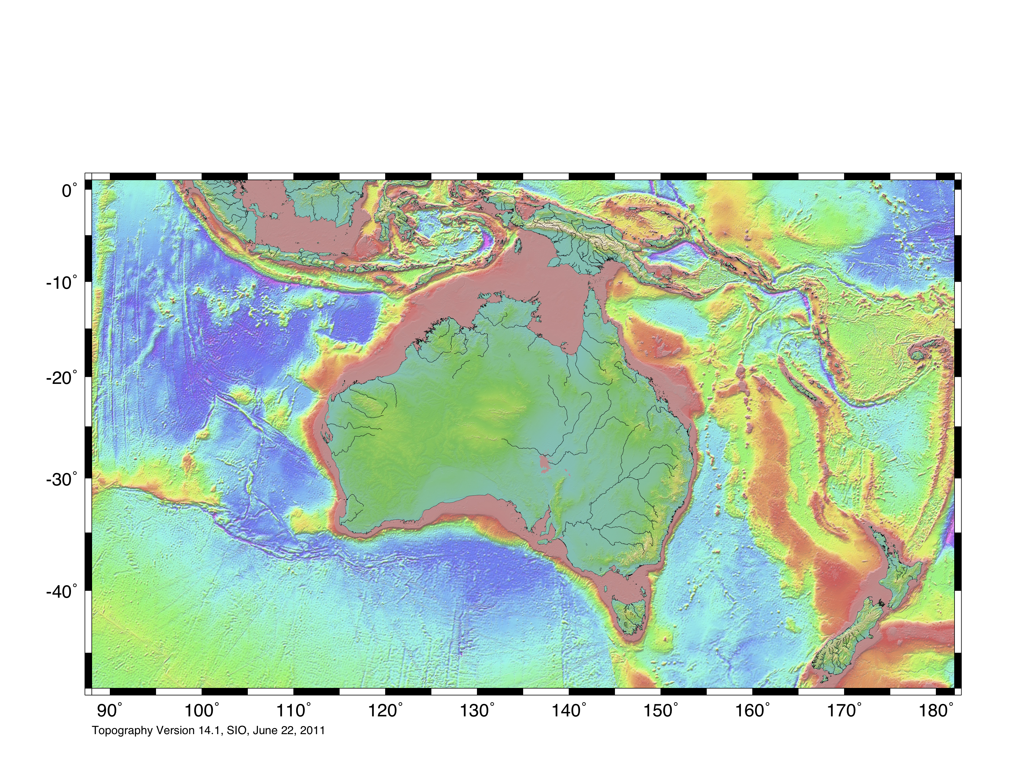
| 来源 | http://topex.ucsd.edu/WWW_html/mar_topo.html; http://topex.ucsd.edu/marine_topo/jpg_images/topo10.jpg; http://topex.ucsd.edu/marine_topo/jpg_images/topo11.jpg; http://topex.ucsd.edu/marine_topo/jpg_images/topo14.jpg; http://topex.ucsd.edu/marine_topo/jpg_images/topo15.jpg |
| 作者 | Ulrich Lange, Bochum, Germany |
| 其他版本 |
 |
There is no copyright on published bathmetry data, (free use)
许可协议
我,本作品著作权人,特此采用以下许可协议发表本作品:
| 本作品采用知识共享CC0 1.0 通用公有领域贡献许可协议授权。 | |
| 采用本宣告发表本作品的人,已在法律允许的范围内,通过在全世界放弃其对本作品拥有的著作权法规定的所有权利(包括所有相关权利),将本作品贡献至公有领域。您可以复制、修改、传播和表演本作品,将其用于商业目的,无需要求授权。
|
文件历史
点击某个日期/时间查看对应时刻的文件。
| 日期/时间 | 缩略图 | 大小 | 用户 | 备注 | |
|---|---|---|---|---|---|
| 当前 | 2019年2月9日 (六) 16:55 | | 1,500 × 1,700(4.57 MB) | Ulanwp | spelling of Bollons Seamount corrected |
| 2017年3月21日 (二) 20:43 |  | 1,500 × 1,700(4.57 MB) | Ulanwp | Geographical Names inserted | |
| 2017年3月20日 (一) 19:59 |  | 1,500 × 1,700(4.44 MB) | Ulanwp | {{Information |Description ={{en|1=Topographic map of Zealandia, based on bathmetry data from Scripps Institution of Oceanography, University of California, San Diego}} |Source =http://topex.ucsd.edu/WWW_html/mar_topo.html |Author =U... |
文件用途
以下页面使用本文件:
全域文件用途
以下其他wiki使用此文件:
- ar.wikipedia.org上的用途
- ast.wikipedia.org上的用途
- bg.wikipedia.org上的用途
- ca.wikipedia.org上的用途
- ceb.wikipedia.org上的用途
- de.wikipedia.org上的用途
- Lord Howe Rise
- Zealandia
- Gisborne-Erdbeben von 2007
- Geologie Neuseelands
- Geographie Neuseelands
- Chatham Rise
- Campbell Plateau
- Bounty Trough
- Norfolk Ridge
- New Caledonia Trough
- Challenger Plateau
- Geologie der Antarktischen Halbinsel
- Geologie Ostantarktikas
- Vulkanische Provinzen der Antarktischen Halbinsel
- en.wikipedia.org上的用途
- Chatham Rise
- Lord Howe Rise
- South Tasman Rise
- Campbell Plateau
- Meiolania
- Challenger Plateau
- Norfolk Ridge
- Lord Howe Seamount Chain
- Continent
- Submerged continent
- East Tasman Plateau
- Bollons Seamount
- Bounty Trough
- Tasmantid Seamount Chain
- Tasmantid hotspot
- Joseph Gilbert Seamount
- Gascoyne Seamount
- Geology of New Caledonia
- Taupo Bank
- Derwent Hunter Guyot
- Britannia Guyots
- Queensland Guyot
- Geology of Zealandia
- Three Kings Ridge
- es.wikipedia.org上的用途
- eu.wikipedia.org上的用途
- fr.wikipedia.org上的用途
查看本文件的更多全域用途。