
File:Southold-town-map.gif
此为最大尺寸。
Southold-town-map.gif (575 × 425像素,文件大小:51 KB,MIME类型:image/gif)
摘要
| 描述 | |
| 日期 | |
| 来源 | http://factfinder.census.gov |
| 作者 | United States Census Bureau |
| 授权 (二次使用本文件) |
Public domain |
许可协议
This image or file is a work of a United States Census Bureau employee, taken or made as part of that person's official duties. As a work of the U.S. federal government, the image is in the public domain.
|
 |
原始上传日志
本檔案是由Cocoloi使用CommonsHelper,從en.wikipedia轉移到維基共享資源。
原始描述頁面位於這裡。下列使用者名稱均來自en.wikipedia。
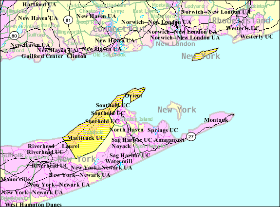
- 2007-10-22 10:57 Americasroof 575×425× (52662 bytes) [[Southold, New York]] map from U.S. Census
文件历史
点击某个日期/时间查看对应时刻的文件。
| 日期/时间 | 缩略图 | 大小 | 用户 | 备注 | |
|---|---|---|---|---|---|
| 当前 | 2009年5月9日 (六) 12:30 | | 575 × 425(51 KB) | File Upload Bot (Magnus Manske) | {{BotMoveToCommons|en.wikipedia|year={{subst:CURRENTYEAR}}|month={{subst:CURRENTMONTHNAME}}|day={{subst:CURRENTDAY}}}} {{Information |Description={{en|en:U.S. Census 2000 reference map for en:Southold, New York}} |Source=Transferred from [htt |
文件用途
以下页面使用本文件:
全域文件用途
以下其他wiki使用此文件:
- azb.wikipedia.org上的用途
- ceb.wikipedia.org上的用途
- de.wikipedia.org上的用途
- en.wikipedia.org上的用途
- es.wikipedia.org上的用途
- fr.wikipedia.org上的用途
- ht.wikipedia.org上的用途
- www.wikidata.org上的用途