
File:PIA17587-MarsCuriosityRover-MurrayButtes-20131113.jpg

原始文件 (1,152 × 1,072像素,文件大小:242 KB,MIME类型:image/jpeg)
摘要
| 描述 |
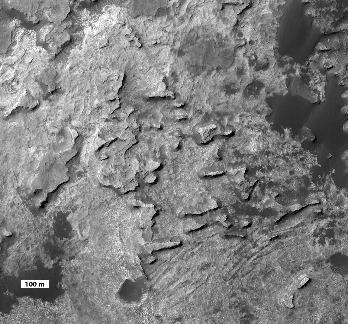
English: PIA17587: 'Murray Buttes' at Foot of Mount Sharp on Mars
http://photojournal.jpl.nasa.gov/catalog/PIA17587 This view taken from orbit shows a cluster of small, steep-sided knobs called "Murray Buttes," on the planned route for NASA's Mars rover Curiosity to reach the slopes of Mount Sharp. The scene covers a patch of ground about 0.8 mile (1.3 kilometers) across. North is up. The largest buttes in the group are about the size of a football field and the height of a goal post. Darker ground at upper right and lower left is part of sand dunes along the northern edge of Mount Sharp, within Gale Crater. Murray Buttes is located at a gap in that band of dunes, making passage through this area an attractive access route to the mountain slopes just south of this scene. Curiosity's science team chose the informal name Murray Buttes in tribute to Bruce Murray (1931-2013), an influential advocate for planetary exploration who was a member of the science teams for NASA's earliest missions to Mars and later served as director of NASA's Jet Propulsion Laboratory. The image is a portion of an observation made by the High Resolution Imaging Science Experiment (HiRISE) camera aboard NASA's Mars Reconnaissance Orbiter. A scale bar of 100 meters (328 feet) is provided at lower left. |
| 日期 | |
| 来源 | http://photojournal.jpl.nasa.gov/jpeg/PIA17587.jpg |
| 作者 | NASA/JPL-Caltech |
许可协议
| 本文件完全由NASA创作,在美国属于公有领域。根据NASA的版权方针,NASA的材料除非另有声明否则不受版权保护。(参见Template:PD-USGov/zh、NASA版权方针页面或JPL图片使用方针。) | ||
 |
警告:
|
文件历史
点击某个日期/时间查看对应时刻的文件。
| 日期/时间 | 缩略图 | 大小 | 用户 | 备注 | |
|---|---|---|---|---|---|
| 当前 | 2013年11月14日 (四) 14:51 | | 1,152 × 1,072(242 KB) | Drbogdan | User created page with UploadWizard |
文件用途
以下页面使用本文件:
全域文件用途
以下其他wiki使用此文件:
- ar.wikipedia.org上的用途
- en.wikipedia.org上的用途
- fa.wikipedia.org上的用途
- fr.wikipedia.org上的用途
- it.wikipedia.org上的用途
- sr.wikipedia.org上的用途
- tr.wikipedia.org上的用途
- uk.wikipedia.org上的用途