
File:OttomanEmpire1801.jpg
本预览的尺寸:758 × 600像素。 其他分辨率:303 × 240像素 | 607 × 480像素 | 971 × 768像素 | 1,280 × 1,013像素 | 1,638 × 1,296像素。
原始文件 (1,638 × 1,296像素,文件大小:605 KB,MIME类型:image/jpeg)

摘要
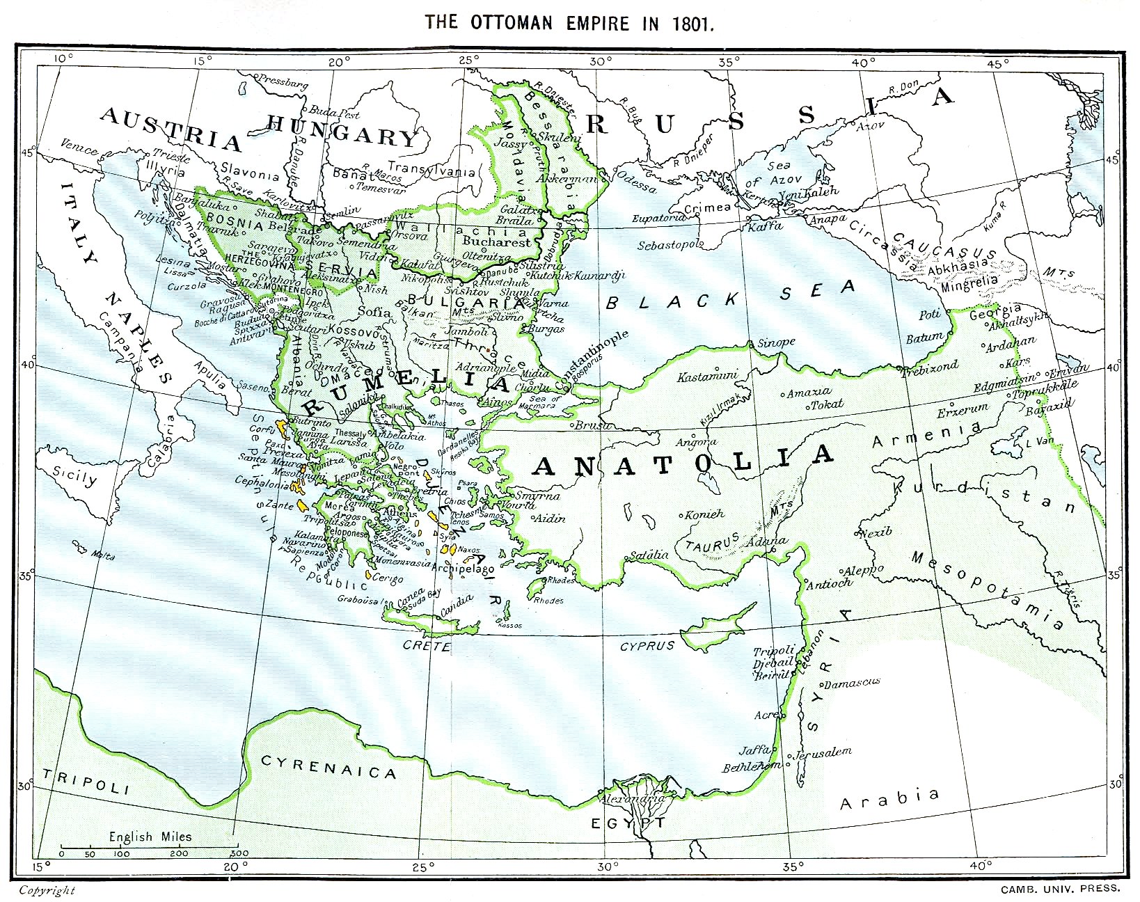
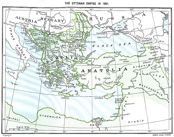
Ottoman Empire (green) and Septinsular Republic (yellow) in 1801.
许可协议
|
本作品在其来源国以及其他著作权期限是作者逝世后70年或以下的国家和地区属于公有领域。
| |
| 本文件已被确认为免除已知的著作权法限制(包括所有相关权利)。 | |
文件历史
点击某个日期/时间查看对应时刻的文件。
| 日期/时间 | 缩略图 | 大小 | 用户 | 备注 | |
|---|---|---|---|---|---|
| 当前 | 2023年1月11日 (三) 16:06 | | 1,638 × 1,296(605 KB) | Enyavar | Reverted to version as of 08:56, 11 March 2006 (UTC) --> even if they are wrong, don't change historical maps! |
| 2014年2月3日 (一) 17:48 |  | 1,638 × 1,296(518 KB) | Spiridon Ion Cepleanu | Some little changes according with the 1801 situation : The Septinsular Rep. includes Ionian Is., not the Cyclades, Serbia became autonomous 1817... | |
| 2006年3月11日 (六) 08:56 |  | 1,638 × 1,296(605 KB) | Julo | Ottoman Empire (green) & Septinsular Republic (yellow) in 1801, on the 19th century map {{PD-old}} category:19th century mapsCategory:Historical maps of the Middle EastCategory:Historical maps of the Balkans[[Category:Historical maps of Africa |
文件用途
没有页面链接到本图像。
全域文件用途
以下其他wiki使用此文件:
- azb.wikipedia.org上的用途
- ba.wikipedia.org上的用途
- el.wikipedia.org上的用途
- fr.wikipedia.org上的用途
- hy.wikipedia.org上的用途
- la.wikipedia.org上的用途
- pl.wikipedia.org上的用途
- sq.wikipedia.org上的用途
- sv.wikipedia.org上的用途
- uk.wikipedia.org上的用途