
File:Muchelney Parish church, abbey foreground ruins.jpg
此为最大尺寸。
Muchelney_Parish_church,_abbey_foreground_ruins.jpg (640 × 427像素,文件大小:87 KB,MIME类型:image/jpeg)
This is a photo of listed building number 1247849. |
| 相机位置 | | 在以下服务上查看本图像和附近其他图像: OpenStreetMap |
|---|
| 物体位置 | | 在以下服务上查看本图像和附近其他图像: OpenStreetMap |
|---|
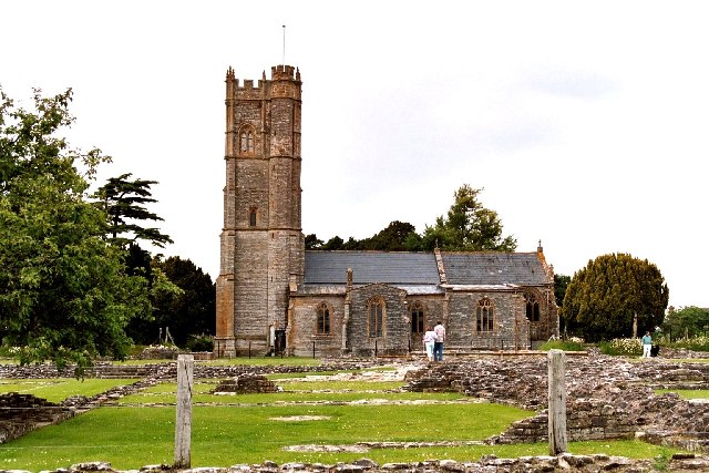
| 描述 | Muchelney Parish church. In the foreground are the ruins of the foundation walls of Muchelney Abbey. | ||
| 日期 | |||
| 来源 | Geograph project | ||
| 作者 | Robert Edwards | ||
| 授权 (二次使用本文件) |
本文件采用知识共享署名-相同方式共享 2.0 通用许可协议授权。 署名: Robert Edwards
|

_region:GB-EAW_&language=zh)
文件历史
点击某个日期/时间查看对应时刻的文件。
| 日期/时间 | 缩略图 | 大小 | 用户 | 备注 | |
|---|---|---|---|---|---|
| 当前 | 2006年11月24日 (五) 16:08 | | 640 × 427(87 KB) | GeeJo | {{Information| |Description = Muchelney Parish church. In the foreground are the ruins of the foundation walls of Muchelney Abbey. |Source = [http://www.geograph.org.uk/photo/85999 Geograph project] |Date = June 2005 |Author = Robe |
文件用途
以下页面使用本文件:
全域文件用途
以下其他wiki使用此文件:
- en.wikipedia.org上的用途
- en.wikivoyage.org上的用途
- es.wikipedia.org上的用途
- fr.wikipedia.org上的用途
- it.wikipedia.org上的用途