
File:Map of the Dutch Cape Colony in 1795.jpg
本预览的尺寸:800 × 475像素。 其他分辨率:320 × 190像素 | 640 × 380像素 | 1,024 × 608像素 | 1,280 × 761像素 | 2,560 × 1,521像素 | 3,546 × 2,107像素。
原始文件 (3,546 × 2,107像素,文件大小:763 KB,MIME类型:image/jpeg)
摘要
| 描述 |
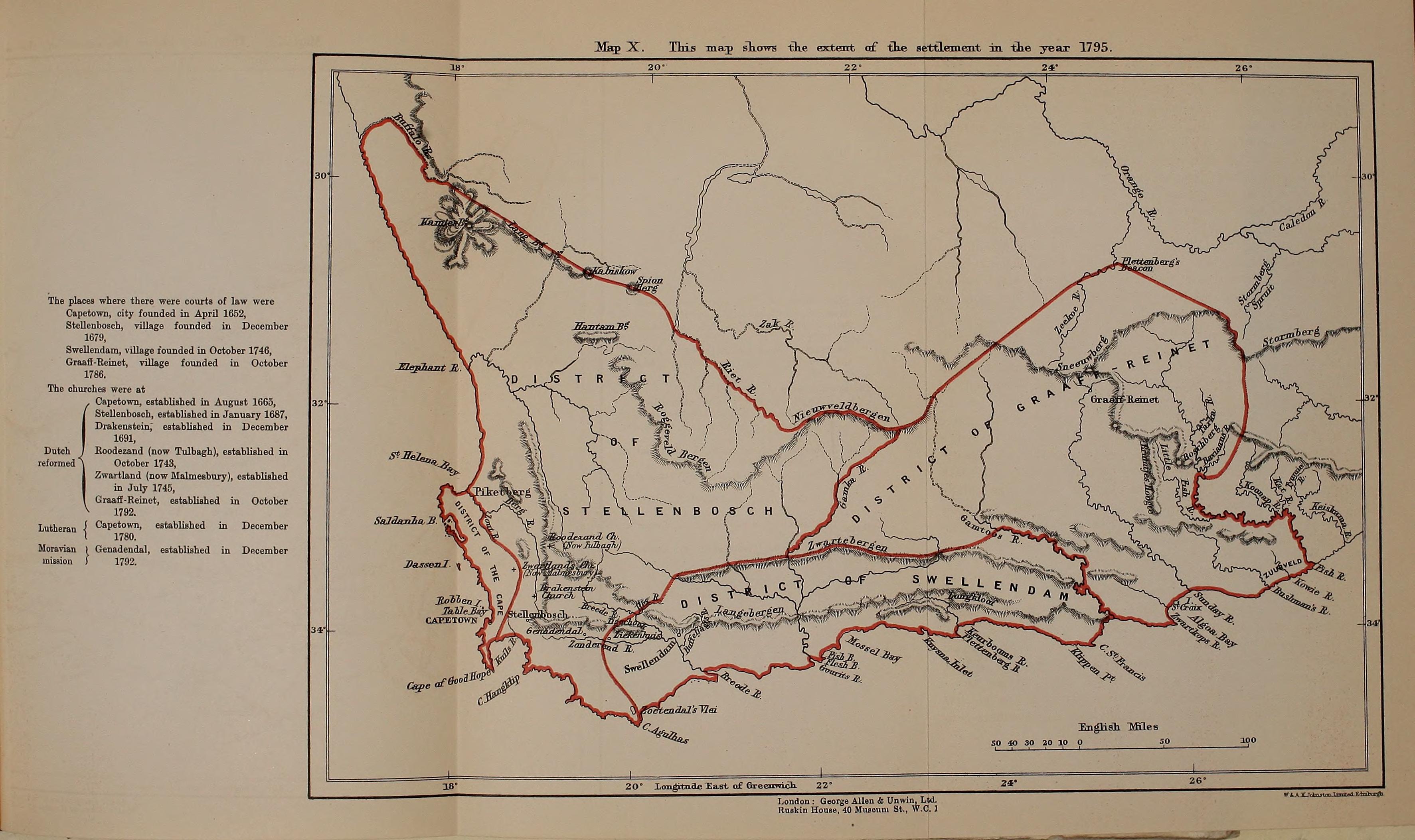
English: Map of the Dutch Cape Colony in 1795, from page 374 of "History of Africa south of the Zambesi - from the settlement of the Portuguese at Sofala in September 1505 to the conquest of the Cape Colony by the British in September 1795" (1916) |
|||||||||||||||||
| 日期 | ||||||||||||||||||
| 来源 | https://archive.org/stream/historyofafricas03thea/historyofafricas03thea#page/n374/mode/1up | |||||||||||||||||
| 作者 |
|
|||||||||||||||||

许可协议
|
本作品在其来源国以及其他著作权期限是作者逝世后70年或以下的国家和地区属于公有领域。 | |
| 本文件已被确认为免除已知的著作权法限制(包括所有相关权利)。 | |
文件历史
点击某个日期/时间查看对应时刻的文件。
| 日期/时间 | 缩略图 | 大小 | 用户 | 备注 | |
|---|---|---|---|---|---|
| 当前 | 2014年8月28日 (四) 21:21 | | 3,546 × 2,107(763 KB) | Underlying lk | User created page with UploadWizard |
文件用途
以下页面使用本文件:
全域文件用途
以下其他wiki使用此文件:
- en.wikipedia.org上的用途
- es.wikipedia.org上的用途
- it.wikipedia.org上的用途
- ru.wikipedia.org上的用途
- simple.wikipedia.org上的用途
- uk.wikipedia.org上的用途