
File:Icy Crater on Mars ESP 016954 2245 subimage 2.jpg

本预览的尺寸:600 × 600像素。 其他分辨率:240 × 240像素 | 480 × 480像素。
原始文件 (800 × 800像素,文件大小:560 KB,MIME类型:image/jpeg)
| 描述 |
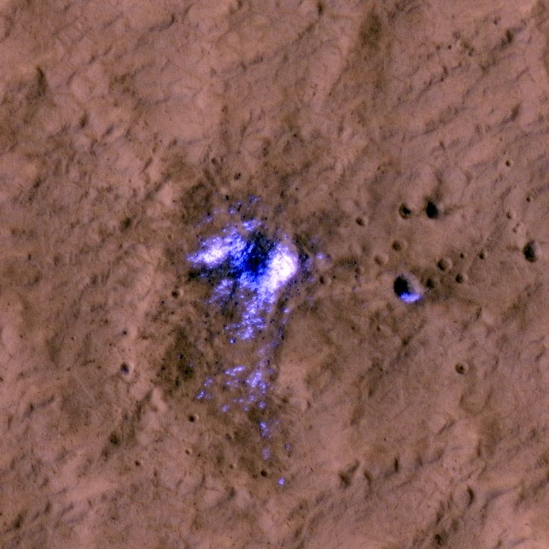
English: A newly formed impact crater, observed by HiRISE on Mars Reconnaissance Orbiter. The impact that formed the crater exposed the water ice beneath the surface. Some of the ice can be seen scattered at the adjascent area in the subimages. The blast zone (excavated dark material) is almost 800 meters (half a mile) across. The crater itself is just over 20 meters (66 feet) across
Ελληνικά: Ένας νεοσχηματισμένος κρατήρας στην επιφάνεια του Άρη. Ο κρατήρας φτάνει μέχρι το στρώμα πάγου που βρίσκεται κάτω από το έδαφος. Εικόνα από το τηλεσκόπιο HiRISE, στη διαστημοσυσκευή Mars Reconnaissance Orbiter της NASA. |
|||||
| 日期 | ||||||
| 来源 | HiRISE webpage with full description, file | |||||
| 作者 | NASA/JPL/University of Arizona | |||||
| 授权 (二次使用本文件) |
|
|||||
| 其他版本 |
  |

| 火星上的位置 | 在以下服务上查看本图像和附近其他图像: Google地图 |
|---|
文件历史
点击某个日期/时间查看对应时刻的文件。
| 日期/时间 | 缩略图 | 大小 | 用户 | 备注 | |
|---|---|---|---|---|---|
| 当前 | 2011年9月18日 (日) 14:49 | | 800 × 800(560 KB) | Badseed | {{Information |Description={{en|A newly formed impact crater, observed by HiRISE on Mars Reconnaissance Orbiter. The impact that formed the crater exposed the water ice beneath the surface. Some of the ice can be seen scattered at the adjascent area in th |
文件用途
以下页面使用本文件:
全域文件用途
以下其他wiki使用此文件:
- ar.wikipedia.org上的用途
- beta.wikiversity.org上的用途
- de.wikipedia.org上的用途
- en.wikiversity.org上的用途
- id.wikipedia.org上的用途
- ru.wikipedia.org上的用途