
File:Gandoman, Iran.jpg

本预览的尺寸:539 × 600像素。 其他分辨率:216 × 240像素 | 431 × 480像素 | 690 × 768像素 | 920 × 1,024像素 | 1,841 × 2,048像素 | 3,146 × 3,500像素。
原始文件 (3,146 × 3,500像素,文件大小:4.47 MB,MIME类型:image/jpeg)
摘要
| 描述 |
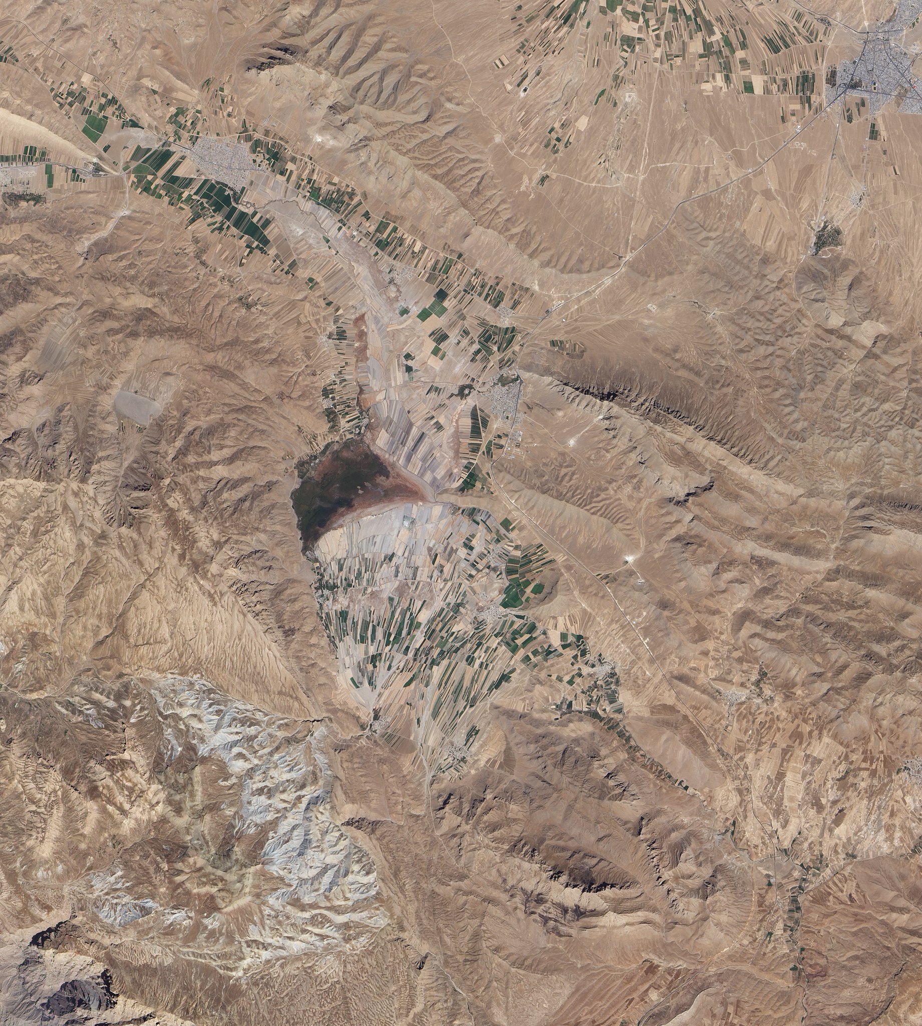
English: Natural-colour image of an area south of Esfahan, including the town of Gandoman. Northwest and south of the city, irrigated fields make elongated rectangles of green, interspersed with earth-toned fallow fields. Crop-lands and settlements are mostly confined to flat areas.
Surrounding the farmed areas are rugged hills and valleys, mostly devoid of vegetation. East north-east of Gandoman, a long ridge casts shadows to the north. It is one of several such ridges visible in this image, and east of the town, the ridges primarily run parallel to each other. In the west, ridge-lines appear more random, extending in multiple directions. Here in the foothills of the Zagros Mountains, elevations are roughly comparable to those of Denver, Colorado, at the base of the foothills of the Rocky Mountains. Near the centre of the image, what might look like a semicircular ridge casting a long, uneven shadow is actually a combination of flat, farmed land bordered on the north by an expanse of natural vegetation. Although water is scarce in this part of Iran, small lakes and wetlands occur sporadically throughout the region. |
| 日期 | |
| 来源 | NASA Earth Observatory |
| 作者 | Jesse Allen and Robert Simmon |
Image captured by the Advanced Land Imager (ALI) on NASA’s Earth Observing-1 (EO-1) satellite.
许可协议
| 本文件完全由NASA创作,在美国属于公有领域。根据NASA的版权方针,NASA的材料除非另有声明否则不受版权保护。(参见Template:PD-USGov/zh、NASA版权方针页面或JPL图片使用方针。) | ||
 |
警告:
|
| 註解 | 該圖片含有註解:在維基媒體共享資源上查看註解 |
文件历史
点击某个日期/时间查看对应时刻的文件。
| 日期/时间 | 缩略图 | 大小 | 用户 | 备注 | |
|---|---|---|---|---|---|
| 当前 | 2010年11月1日 (一) 11:02 | | 3,146 × 3,500(4.47 MB) | Originalwana | {{Information |Description={{en|1=Natural-colour image of an area south of Esfahan, including the town of Gandoman. Northwest and south of the city, irrigated fields make elongated rectangles of green, interspersed with earth-toned [[:Category:Fal |
文件用途
以下页面使用本文件:
全域文件用途
以下其他wiki使用此文件:
- ar.wikipedia.org上的用途
- az.wikipedia.org上的用途
- ceb.wikipedia.org上的用途
- en.wikipedia.org上的用途
- fa.wikipedia.org上的用途
- it.wikipedia.org上的用途
- mg.wikipedia.org上的用途
- ru.wikipedia.org上的用途
- tr.wikipedia.org上的用途
- ur.wikipedia.org上的用途
- uz.wikipedia.org上的用途
- www.wikidata.org上的用途