
File:Forests in Oliver Township.jpg

本预览的尺寸:800 × 596像素。 其他分辨率:320 × 239像素 | 640 × 477像素 | 1,024 × 763像素 | 1,280 × 954像素 | 2,576 × 1,920像素。
原始文件 (2,576 × 1,920像素,文件大小:1.98 MB,MIME类型:image/jpeg)
| 描述 |
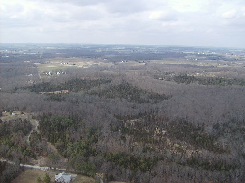
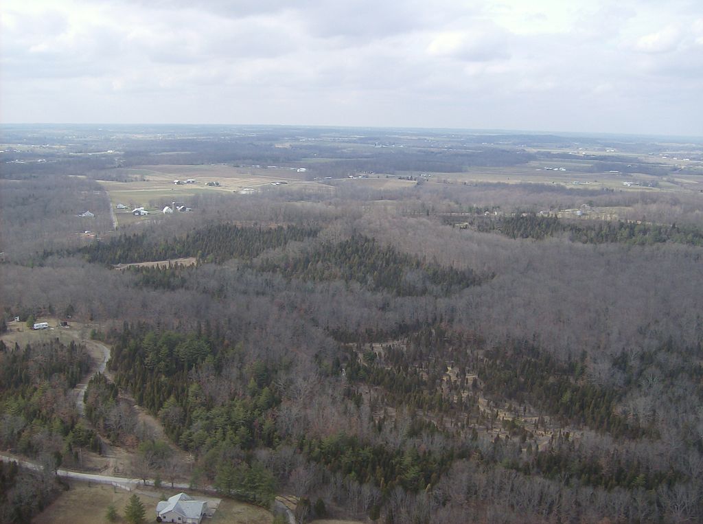
English: Countryside in southwestern Oliver Township, Adams County, Ohio, United States. Road in bottom right corner is Tom Brown Road, halfway between Unity Road and State Route 247. Picture taken from a Diamond Eclipse light airplane (just before landing at Alexander Salamon Airport) at an altitude of 1,400 feet MSL and a bearing of approximately 308º. |
||
| 日期 | 摄于2008年3月6日 | ||
| 来源 | 自己的作品 | ||
| 作者 | Nyttend | ||
| 授权 (二次使用本文件) |
|
文件历史
点击某个日期/时间查看对应时刻的文件。
| 日期/时间 | 缩略图 | 大小 | 用户 | 备注 | |
|---|---|---|---|---|---|
| 当前 | 2008年5月26日 (一) 02:01 | | 2,576 × 1,920(1.98 MB) | Nyttend | {{Information |Description=Countryside in southwestern {{w|Oliver Township, Adams County, Ohio|Oliver Township}}, {{w|Adams County, Ohio|Adams County}}, {{w|Ohio}}, {{w|United States}}. Road in bottom right corner is Tom Brown Road, halfway between Unity |
文件用途
以下页面使用本文件:
全域文件用途
以下其他wiki使用此文件:
- de.wikipedia.org上的用途
- en.wikipedia.org上的用途
- es.wikipedia.org上的用途
- eu.wikipedia.org上的用途
- fa.wikipedia.org上的用途
- fr.wikipedia.org上的用途
- pt.wikipedia.org上的用途
- ur.wikipedia.org上的用途
- vi.wikipedia.org上的用途
- www.wikidata.org上的用途