
File:False color of Hellas Planitia.jpeg

本预览的尺寸:486 × 599像素。 其他分辨率:195 × 240像素 | 389 × 480像素 | 623 × 768像素 | 831 × 1,024像素 | 1,909 × 2,353像素。
原始文件 (1,909 × 2,353像素,文件大小:881 KB,MIME类型:image/jpeg)
摘要
| 描述 |
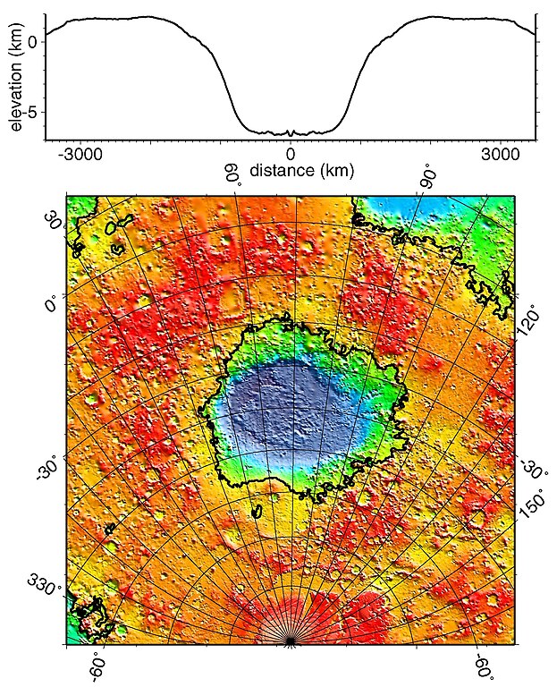
English: Regional topographic model of the Hellas basin (Hellas Planitia) taken by the MOLA instrument aboard the Mars Global Surveyor. (Top) Azimuthally-averaged radial topography used in the calculation of infilling the basin with surrounding material postulated to have been excavated from it. (Bottom) Color-coded topography plotted in an equal-area projection. The black lines correspond to zero-elevation contours. |
| 日期 | |
| 来源 | http://photojournal.jpl.nasa.gov/catalog/PIA02033 |
| 作者 | NASA/JPL/GSFC |
许可协议
| 本文件完全由NASA创作,在美国属于公有领域。根据NASA的版权方针,NASA的材料除非另有声明否则不受版权保护。(参见Template:PD-USGov/zh、NASA版权方针页面或JPL图片使用方针。) | ||
 |
警告:
|
文件历史
点击某个日期/时间查看对应时刻的文件。
| 日期/时间 | 缩略图 | 大小 | 用户 | 备注 | |
|---|---|---|---|---|---|
| 当前 | 2010年12月19日 (日) 18:51 | | 1,909 × 2,353(881 KB) | Orionist | high res version from original source |
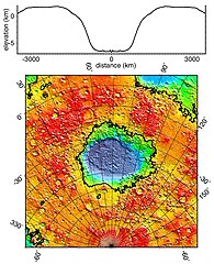
| 2006年2月2日 (四) 23:42 |  | 274 × 337(78 KB) | W-j-s | Hellas Planitia, NASA From [http://rst.gsfc.nasa.gov/Sect19/Sect19_12.html] {{PD-USGov-NASA}} |
文件用途
全域文件用途
以下其他wiki使用此文件:
- als.wikipedia.org上的用途
- ca.wikipedia.org上的用途
- de.wikipedia.org上的用途
- el.wikipedia.org上的用途
- en.wikipedia.org上的用途
- fr.wikipedia.org上的用途
- gl.wikipedia.org上的用途
- hy.wikipedia.org上的用途
- it.wikipedia.org上的用途
- ja.wikipedia.org上的用途
- lb.wikipedia.org上的用途
- ml.wikipedia.org上的用途
- pnb.wikipedia.org上的用途
- pt.wikipedia.org上的用途
- ro.wikipedia.org上的用途
- ru.wikipedia.org上的用途
- uk.wikipedia.org上的用途
- ur.wikipedia.org上的用途