
File:DEMBauges.png

本预览的尺寸:669 × 599像素。 其他分辨率:268 × 240像素 | 536 × 480像素 | 858 × 768像素 | 1,143 × 1,024像素 | 1,858 × 1,664像素。
原始文件 (1,858 × 1,664像素,文件大小:1.34 MB,MIME类型:image/png)
摘要
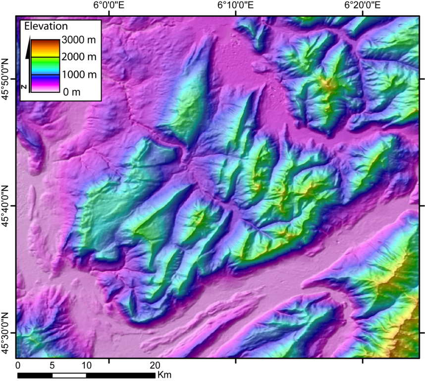
| 描述 | DEM of the Bauges massifs (french Alps) created by Jide from the 90m pixel size SRTM dataset. The massif is located between the Bourget Lake (to the West) and the Annecy Lake (to the NE). The ENE-WSW valley to the South is the Isere valley downstrem to the West). The Cheran river cut the massif from the SE to the NW. |
| 日期 | 2005年11月5日 (原始上传日期) |
| 来源 | 无法识别来源。根据版权声明推断为其自己的作品。 |
| 作者 | 无法识别作者。根据版权声明推断作者为Jide~commonswiki。 |
许可协议
| 我,本作品著作权人,释出本作品至公有领域。这适用于全世界。 在一些国家这可能不合法;如果是这样的话,那么: 我无条件地授予任何人以任何目的使用本作品的权利,除非这些条件是法律规定所必需的。 |
文件历史
点击某个日期/时间查看对应时刻的文件。
| 日期/时间 | 缩略图 | 大小 | 用户 | 备注 | |
|---|---|---|---|---|---|
| 当前 | 2005年11月5日 (六) 00:29 | | 1,858 × 1,664(1.34 MB) | Jide~commonswiki | DEM of the Bauges massifs (french Alps) created by Jide from the 90m pixel size SRTM dataset. The massif is located between the Bourget Lake (to the West) and the Annecy Lake (to the NE). The ENE-WSW valley to the South is the Isere valley downstrem to th |
文件用途
以下页面使用本文件:
全域文件用途
以下其他wiki使用此文件: