
File:Costa Rica relief location map.jpg

本预览的尺寸:666 × 600像素。 其他分辨率:267 × 240像素 | 533 × 480像素 | 853 × 768像素 | 1,148 × 1,034像素。
原始文件 (1,148 × 1,034像素,文件大小:841 KB,MIME类型:image/jpeg)
摘要
| 相机位置 | | 在以下服务上查看本图像和附近其他图像: OpenStreetMap |
|---|
| 描述 |
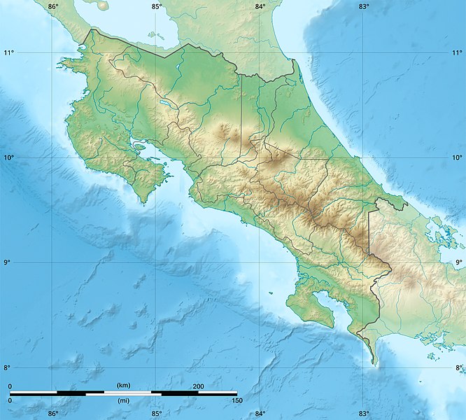
English: Blank relief map of Costa Rica for geo-location purpose.
Note : The Isla del Coco, out of the map, is not shown. Scale : 1:1,856,000 (accuracy : 464 m) Français : Carte du relief vierge du Costa Rica destinée à la géolocalisation.
Note : L´Isla del Coco, hors carte, n'est pas représentée. Échelle : 1:1 856 000 (précision : 464 m) Equirectangular projection centered on 9° 30' N – 84° 15' W, WGS84 datum * West : 86° 30' W * East : 82° W * North : 11° 30' N * South : 7° 30' N |
||
| 日期 | 2008-06, updated 2022-03 | ||
| 来源 |
自己的作品
|
||
| 作者 | Eric Gaba (Sting - fr:Sting) | ||
| 授权 (二次使用本文件) |
|
||
| 其他版本 |
|

许可协议
Eric Gaba (user Sting) for Wikimedia Commons using GEBCO_2021 Grid data,本作品著作权人,特此采用以下许可协议发表本作品:

|
已授权您依据自由软件基金会发行的无固定段落及封面封底文字(Invariant Sections, Front-Cover Texts, and Back-Cover Texts)的GNU自由文件许可协议1.2版或任意后续版本的条款,复制、传播和/或修改本文件。该协议的副本请见“GNU Free Documentation License”。 |
This file is licensed under the Creative Commons Attribution-Share Alike 4.0 International, 3.0 Unported, 2.5 Generic, 2.0 Generic and 1.0 Generic license.
署名: Eric Gaba (user Sting) for Wikimedia Commons using GEBCO_2021 Grid data
- 您可以自由地:
- 共享 – 复制、发行并传播本作品
- 修改 – 改编作品
- 惟须遵守下列条件:
- 署名 – 您必须对作品进行署名,提供授权条款的链接,并说明是否对原始内容进行了更改。您可以用任何合理的方式来署名,但不得以任何方式表明许可人认可您或您的使用。
- 相同方式共享 – 如果您再混合、转换或者基于本作品进行创作,您必须以与原先许可协议相同或相兼容的许可协议分发您贡献的作品。
您可以选择您需要的许可协议。
文件历史
点击某个日期/时间查看对应时刻的文件。
| 日期/时间 | 缩略图 | 大小 | 用户 | 备注 | |
|---|---|---|---|---|---|
| 当前 | 2022年3月30日 (三) 22:51 | | 1,148 × 1,034(841 KB) | Sting | New map using new data |
| 2021年11月4日 (四) 01:32 |  | 1,148 × 1,034(906 KB) | RoboQwezt0x7CB | hand edited to remove non-existing waterbodies, used lower elevation green shade to bucket fill (best I can do without the tools to generate the map) particulary in the south of the country (probably an altitude render/clipping error), kept some that are hydroelectric plant's reservoirs | |
| 2010年7月19日 (一) 12:11 |  | 1,148 × 1,034(500 KB) | Sting | Color profile | |
| 2008年7月30日 (三) 15:05 |  | 1,148 × 1,034(491 KB) | Sting | - border | |
| 2008年6月13日 (五) 14:40 |  | 1,148 × 1,034(499 KB) | Sting | Several improvements | |
| 2008年6月12日 (四) 01:21 |  | 1,148 × 1,034(501 KB) | Sting | Correction on shaded layer | |
| 2008年6月12日 (四) 01:09 |  | 1,148 × 1,034(504 KB) | Sting | == Summary == {{Location|10|00|00|N|84|00|00|W|scale:2000000}} <br/> {{Information |Description={{en|Blank relief map of Costa Rica for geo-location purpose.<br/>''Note :'' The ''Isla del Coco'', out of the map, is not shown.<br/>Scale |
文件用途
以下11个页面使用本文件:
全域文件用途
以下其他wiki使用此文件:
- ar.wikipedia.org上的用途
- ast.wikipedia.org上的用途
- azb.wikipedia.org上的用途
- az.wikipedia.org上的用途
- ban.wikipedia.org上的用途
- ba.wikipedia.org上的用途
- be.wikipedia.org上的用途
- bg.wikipedia.org上的用途
- bn.wikipedia.org上的用途
- bs.wikipedia.org上的用途
- ca.wikipedia.org上的用途
- ceb.wikipedia.org上的用途
- ce.wikipedia.org上的用途
- ckb.wikipedia.org上的用途
- cs.wikipedia.org上的用途
查看本文件的更多全域用途。