
File:Bayou des Allemands.jpg
本预览的尺寸:800 × 533像素。 其他分辨率:320 × 213像素 | 640 × 427像素 | 1,024 × 683像素 | 1,500 × 1,000像素。
原始文件 (1,500 × 1,000像素,文件大小:333 KB,MIME类型:image/jpeg)
| 描述 |
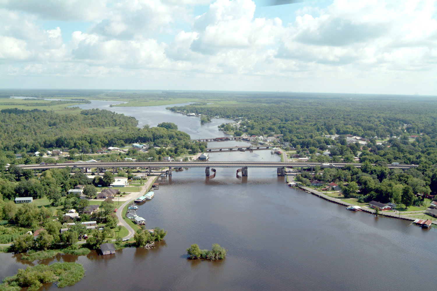
English: Bayou des Allemands and the town of Des Allemands, Louisiana, USA. The bayou is the boundary between St. Charles Parish (right) and Lafourche Parish (left). The three bridges crossing the bayou are (farthest to closest): A railroad bridge, Louisiana State Route 631, and U.S. Route 90. View is to the north. |
|||
| 日期 | ||||
| 来源 |
U.S. Army Corps of Engineers Digital Visual Library Image page Image description page Digital Visual Library home page |
|||
| 作者 | Lane Lefort, U.S. Army Corps of Engineers | |||
| 授权 (二次使用本文件) |
|
|||
| 图中地点 | Des Allemands, Louisiana, USA |
| 相机位置 | | 在以下服务上查看本图像和附近其他图像: OpenStreetMap |
|---|
文件历史
点击某个日期/时间查看对应时刻的文件。
| 日期/时间 | 缩略图 | 大小 | 用户 | 备注 | |
|---|---|---|---|---|---|
| 当前 | 2007年4月7日 (六) 22:41 | | 1,500 × 1,000(333 KB) | DanMS | {{Information | Description = {{en|Bayou des Allemands and the town of Des Allemands, Louisiana, USA. The bayou is the boundary between St. Charles Parish (right) and Lafourche Parish (left). The three bridges crossing the bayou are (farthest to closes |
文件用途
以下页面使用本文件:
全域文件用途
以下其他wiki使用此文件:
- ar.wikipedia.org上的用途
- ca.wikipedia.org上的用途
- ceb.wikipedia.org上的用途
- ce.wikipedia.org上的用途
- cy.wikipedia.org上的用途
- de.wikipedia.org上的用途
- en.wikipedia.org上的用途
- es.wikipedia.org上的用途
- fa.wikipedia.org上的用途
- fr.wikipedia.org上的用途
- fy.wikipedia.org上的用途
- it.wikipedia.org上的用途
- lld.wikipedia.org上的用途
- nl.wikipedia.org上的用途
- pl.wikipedia.org上的用途
- pt.wikipedia.org上的用途
- sh.wikipedia.org上的用途
- sr.wikipedia.org上的用途
- th.wikipedia.org上的用途
- tt.wikipedia.org上的用途
- uk.wikipedia.org上的用途
- www.wikidata.org上的用途
- zh-min-nan.wikipedia.org上的用途